

Bohnental-Rundwanderweg
A cycling route starting in Tholey, Saarland, Germany.
Overview
About this route
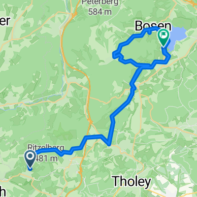
The hiking trail connects the five villages of the Bohnental valley: Scheuern, Neipel, Dorf im Bohnental, Lindscheid, and Überroth-Niederhofen. The hike goes over hilly terrain with several ascents and is rated as moderate.
The tour impresses with magnificent viewpoints equipped with panoramic panels and sensory benches. The hiker is offered wide views over the picturesque Bohnental, the heights of the Hunsrück, the upper and lower Primstal, the Göttelborn Heights, as well as the heights of the Saargau.
With the local history museum 'Haus am Mühlenpfad' in Neipel and the parish church 'St. Katharina' in Scheuern, the trail features attractive sights.
Length: 14.3 km Walking time: 4 hours Direction: Counterclockwise (official) - Clockwise (me)
Start/Finish: Church parking lot Scheuern
Navigation: Dörsdorfer Straße 1 66636 Tholey - Scheuern
- -:--
- Duration
- 14.3 km
- Distance
- 300 m
- Ascent
- 298 m
- Descent
- ---
- Avg. speed
- ---
- Max. altitude
Route quality
Waytypes & surfaces along the route
Waytypes
Track
7.1 km
(50 %)
Path
2.4 km
(17 %)
Surfaces
Paved
4 km
(28 %)
Unpaved
7.6 km
(53 %)
Gravel
3.6 km
(25 %)
Ground
3.3 km
(23 %)
Route highlights
Points of interest along the route

Point of interest after 7.6 km
Aussichtspunkt
Continue with Bikemap
Use, edit, or download this cycling route
You would like to ride Bohnental-Rundwanderweg or customize it for your own trip? Here is what you can do with this Bikemap route:
Free features
- Save this route as favorite or in collections
- Copy & plan your own version of this route
- Sync your route with Garmin or Wahoo
Premium features
Free trial for 3 days, or one-time payment. More about Bikemap Premium.
- Navigate this route on iOS & Android
- Export a GPX / KML file of this route
- Create your custom printout (try it for free)
- Download this route for offline navigation
Discover more Premium features.
Get Bikemap PremiumFrom our community
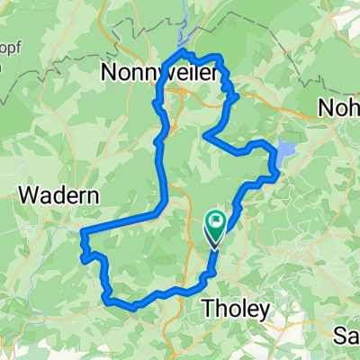
Other popular routes starting in Tholey
 3-Seen-Tour
- Distance
- 59.6 km
- Ascent
- 827 m
- Descent
- 840 m
- Location
- Tholey, Saarland, Germany
 3-Seen-Tour
- Distance
- 59.6 km
- Ascent
- 851 m
- Descent
- 852 m
- Location
- Tholey, Saarland, Germany
 St.Wendeler Land
- Distance
- 51.1 km
- Ascent
- 1,816 m
- Descent
- 1,817 m
- Location
- Tholey, Saarland, Germany
 scheuern zum Bostalsee und zurück
- Distance
- 42 km
- Ascent
- 817 m
- Descent
- 781 m
- Location
- Tholey, Saarland, Germany
 Jahann-Adams-Mühle-Theley-Oberthal-Bostalsee-Selbach Nahequelle-Theley
- Distance
- 29.4 km
- Ascent
- 506 m
- Descent
- 509 m
- Location
- Tholey, Saarland, Germany
 Bohnental-Rundwanderweg
- Distance
- 14.3 km
- Ascent
- 300 m
- Descent
- 298 m
- Location
- Tholey, Saarland, Germany
 Unnamed Road, Tholey nach Primstalstraße 1, Tholey
- Distance
- 3.8 km
- Ascent
- 33 m
- Descent
- 69 m
- Location
- Tholey, Saarland, Germany
 Hofgut Imsbach - Zwei Seen Tour
- Distance
- 54.8 km
- Ascent
- 923 m
- Descent
- 924 m
- Location
- Tholey, Saarland, Germany
Open it in the app