

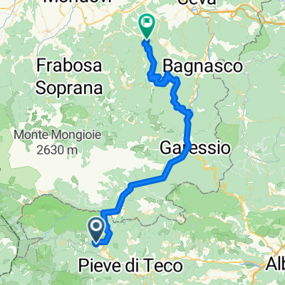
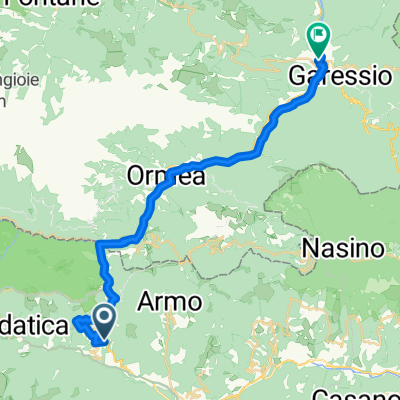
strada militare nava-colle san bernardo-colle garezzo-collardente-marta
A cycling route starting in Pornassio, Liguria, Italy.
Overview
About this route
- -:--
- Duration
- 28.8 km
- Distance
- 2,455 m
- Ascent
- 1,709 m
- Descent
- ---
- Avg. speed
- 1,778 m
- Max. altitude
Route quality
Waytypes & surfaces along the route
Waytypes
Track
18.2 km
(63 %)
Quiet road
1.2 km
(4 %)
Surfaces
Paved
2.6 km
(9 %)
Unpaved
18.5 km
(64 %)
Gravel
12.7 km
(44 %)
Unpaved (undefined)
5.2 km
(18 %)
Route highlights
Points of interest along the route
Point of interest after 0 km
geocache GC1WCXA
Point of interest after 0.8 km
geocache GC1Y7FY
Continue with Bikemap
Use, edit, or download this cycling route
You would like to ride strada militare nava-colle san bernardo-colle garezzo-collardente-marta or customize it for your own trip? Here is what you can do with this Bikemap route:
Free features
- Save this route as favorite or in collections
- Copy & plan your own version of this route
- Sync your route with Garmin or Wahoo
Premium features
Free trial for 3 days, or one-time payment. More about Bikemap Premium.
- Navigate this route on iOS & Android
- Export a GPX / KML file of this route
- Create your custom printout (try it for free)
- Download this route for offline navigation
Discover more Premium features.
Get Bikemap PremiumFrom our community
Other popular routes starting in Pornassio
 Pornassio - Monasterolo Casotto
- Distance
- 60.2 km
- Ascent
- 2,893 m
- Descent
- 2,833 m
- Location
- Pornassio, Liguria, Italy
 SS28 Nord 77, Colle di Nava to Corso Matuzia 41, Sanremo
- Distance
- 70.1 km
- Ascent
- 726 m
- Descent
- 1,649 m
- Location
- Pornassio, Liguria, Italy
 EV8 3-Cosio di Arroscia - Garessio
- Distance
- 29.5 km
- Ascent
- 1,364 m
- Descent
- 1,384 m
- Location
- Pornassio, Liguria, Italy
 Colle delle Salse
- Distance
- 54.7 km
- Ascent
- 2,094 m
- Descent
- 2,095 m
- Location
- Pornassio, Liguria, Italy
 anello colle di nava
- Distance
- 30.9 km
- Ascent
- 912 m
- Descent
- 910 m
- Location
- Pornassio, Liguria, Italy
 Col di Nava
- Distance
- 46.5 km
- Ascent
- 1,295 m
- Descent
- 1,265 m
- Location
- Pornassio, Liguria, Italy
 LIGURIA-PON-17MAR-DAY-3
- Distance
- 90 km
- Ascent
- 1,693 m
- Descent
- 2,594 m
- Location
- Pornassio, Liguria, Italy
 Colle San Bernardo di Mendatica
- Distance
- 35.4 km
- Ascent
- 1,182 m
- Descent
- 1,182 m
- Location
- Pornassio, Liguria, Italy
Open it in the app