

Bleszczyn-Gajówka-Zbiornik Przykona
A cycling route starting in Dobra, Greater Poland Voivodeship, Poland.
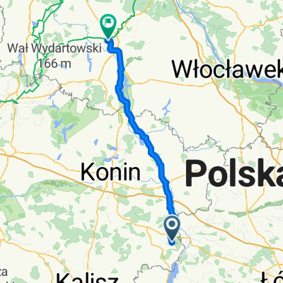
Overview
About this route
Most of the route runs along bike paths and streets with low traffic volume. Depending on your preference, you can skip the section through Czarny Las (gravel surface) and head directly through Smulsko to the reservoir.
- -:--
- Duration
- 30.9 km
- Distance
- 56 m
- Ascent
- 55 m
- Descent
- ---
- Avg. speed
- ---
- Max. altitude

Route quality
Waytypes & surfaces along the route
Waytypes
Quiet road
11.1 km
(36 %)
Track
7.4 km
(24 %)
Surfaces
Paved
26.9 km
(87 %)
Unpaved
0.3 km
(1 %)
Asphalt
19.5 km
(63 %)
Paved (undefined)
7.4 km
(24 %)
Continue with Bikemap
Use, edit, or download this cycling route
You would like to ride Bleszczyn-Gajówka-Zbiornik Przykona or customize it for your own trip? Here is what you can do with this Bikemap route:
Free features
- Save this route as favorite or in collections
- Copy & plan your own version of this route
- Sync your route with Garmin or Wahoo
Premium features
Free trial for 3 days, or one-time payment. More about Bikemap Premium.
- Navigate this route on iOS & Android
- Export a GPX / KML file of this route
- Create your custom printout (try it for free)
- Download this route for offline navigation
Discover more Premium features.
Get Bikemap PremiumFrom our community
Other popular routes starting in Dobra
 Z Mateuszem
- Distance
- 45.3 km
- Ascent
- 68 m
- Descent
- 70 m
- Location
- Dobra, Greater Poland Voivodeship, Poland
 Boleszczyn-Koło-Chełmno-Dąbie-Uniejów
- Distance
- 92.6 km
- Ascent
- 118 m
- Descent
- 115 m
- Location
- Dobra, Greater Poland Voivodeship, Poland
 Boleszczyn-Przykona-Dobra
- Distance
- 31.4 km
- Ascent
- 63 m
- Descent
- 61 m
- Location
- Dobra, Greater Poland Voivodeship, Poland
 Inowrocław
- Distance
- 123 km
- Ascent
- 88 m
- Descent
- 120 m
- Location
- Dobra, Greater Poland Voivodeship, Poland
 Bleszczyn-Gajówka-Zbiornik Przykona
- Distance
- 30.9 km
- Ascent
- 56 m
- Descent
- 55 m
- Location
- Dobra, Greater Poland Voivodeship, Poland
 Kujawy
- Distance
- 147.5 km
- Ascent
- 141 m
- Descent
- 138 m
- Location
- Dobra, Greater Poland Voivodeship, Poland
 Turek, Władysławów
- Distance
- 64.9 km
- Ascent
- 151 m
- Descent
- 153 m
- Location
- Dobra, Greater Poland Voivodeship, Poland
 Kowal, Kosinowo
- Distance
- 222 km
- Ascent
- 210 m
- Descent
- 210 m
- Location
- Dobra, Greater Poland Voivodeship, Poland
Open it in the app