

XC Lesumer Tour
A cycling route starting in Lemwerder, Lower Saxony, Germany.
Overview
About this route
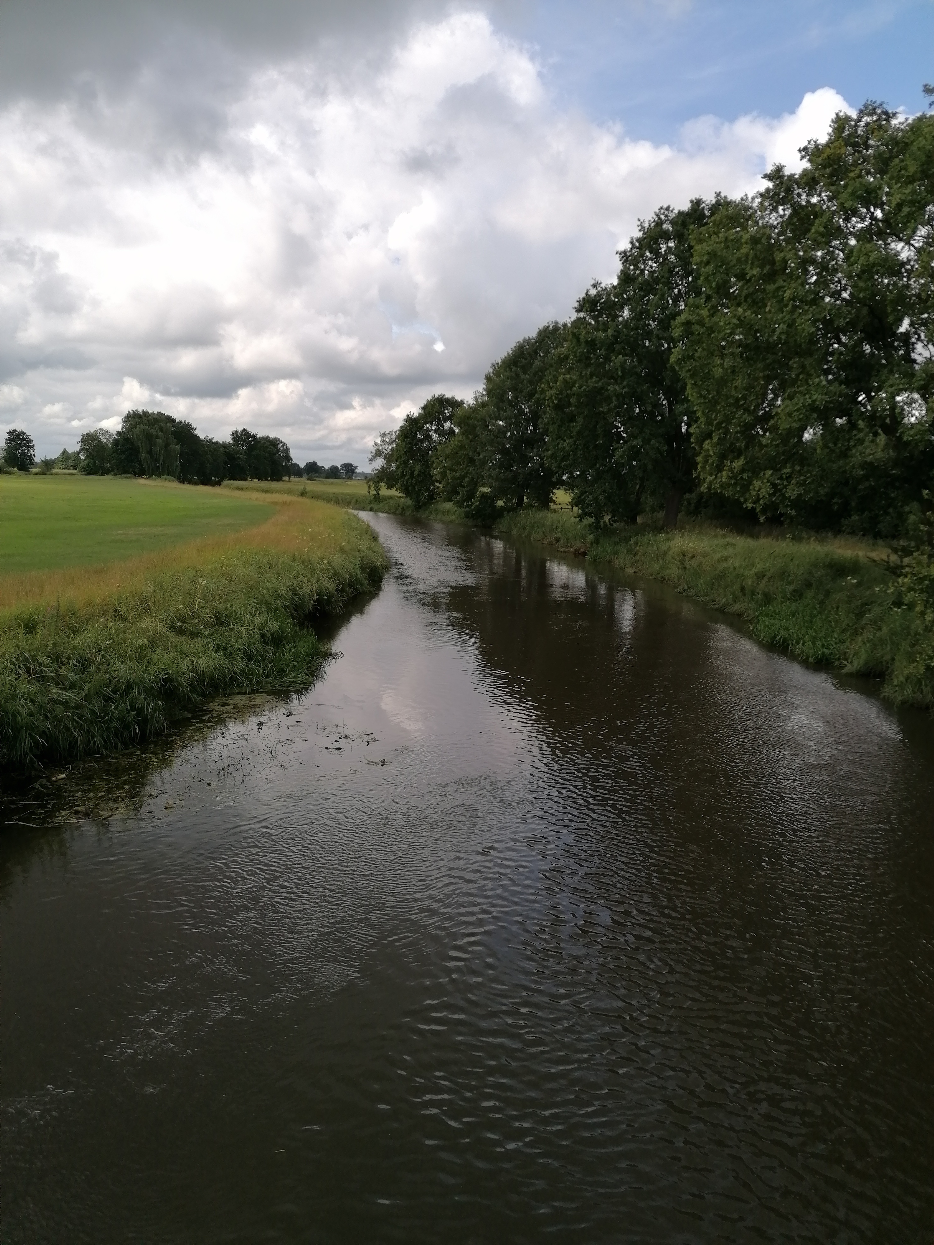
From Bremen North, you cross the route along the Lesum on the Weser through the Werderland nature reserve to Lesum, Wümme, and Hamme. East of Osterholz, the route continues to the Garlstedt military training area and back through Gut Hohehorst to St. Magnus. Bike-friendly restaurants and beer gardens are marked on the map.
Depending on the weather, some paths in the Garlstedt moor are only partially rideable.
** Do you have suggestions or improvements for the route? Then please write a comment ;-)
- -:--
- Duration
- 92.4 km
- Distance
- 136 m
- Ascent
- 136 m
- Descent
- ---
- Avg. speed
- ---
- Max. altitude
Route quality
Waytypes & surfaces along the route
Waytypes
Track
38.8 km
(42 %)
Quiet road
27.7 km
(30 %)
Surfaces
Paved
43.4 km
(47 %)
Unpaved
37 km
(40 %)
Asphalt
26.8 km
(29 %)
Paved (undefined)
12.9 km
(14 %)
Route highlights
Points of interest along the route
Point of interest after 0.1 km
Restaurant und Cafe Kränholm
Point of interest after 7.8 km
Zur Moorlosen Kirche Restaurant/Biergarten http://www.an-der-moorlosen-kirche.de

Point of interest after 29.7 km
Tietjans Hütte http://www.tietjens-huette.de/

Point of interest after 33.6 km
Melchers Hütte http://www.teufelsmoor.eu/ausfluge/melchers-hutte/
Point of interest after 69.4 km
Biergarten am Wald http://www.am-wald-biergarten-und-minigolf.de/speise-und-getr%C3%A4nkekarte/
Continue with Bikemap
Use, edit, or download this cycling route
You would like to ride XC Lesumer Tour or customize it for your own trip? Here is what you can do with this Bikemap route:
Free features
- Save this route as favorite or in collections
- Copy & plan your own version of this route
- Split it into stages to create a multi-day tour
- Sync your route with Garmin or Wahoo
Premium features
Free trial for 3 days, or one-time payment. More about Bikemap Premium.
- Navigate this route on iOS & Android
- Export a GPX / KML file of this route
- Create your custom printout (try it for free)
- Download this route for offline navigation
Discover more Premium features.
Get Bikemap PremiumFrom our community
Other popular routes starting in Lemwerder
 Am Vegesacker Hafen, Bremen nach Weserpromenade, Bremen
- Distance
- 32.2 km
- Ascent
- 81 m
- Descent
- 75 m
- Location
- Lemwerder, Lower Saxony, Germany
 30-1) Lemwer-Sannau-Seehausen-Lemwerder
- Distance
- 31 km
- Ascent
- 22 m
- Descent
- 19 m
- Location
- Lemwerder, Lower Saxony, Germany
 Lesum, Wümme, Wümmewiesen und Fischerhude
- Distance
- 84.1 km
- Ascent
- 343 m
- Descent
- 395 m
- Location
- Lemwerder, Lower Saxony, Germany
 Grävenhorster Straße, Bremen nach Riesstraße, Ritterhude
- Distance
- 14.5 km
- Ascent
- 63 m
- Descent
- 80 m
- Location
- Lemwerder, Lower Saxony, Germany
 BR07_Bremen-Lesum-Mittelsbüren
- Distance
- 37.3 km
- Ascent
- 103 m
- Descent
- 106 m
- Location
- Lemwerder, Lower Saxony, Germany
 RTF Vegesack 2009 (125km-Runde)
- Distance
- 116.4 km
- Ascent
- 303 m
- Descent
- 290 m
- Location
- Lemwerder, Lower Saxony, Germany
 Etappe 14(Bremen - Hamburg)
- Distance
- 121.4 km
- Ascent
- 269 m
- Descent
- 284 m
- Location
- Lemwerder, Lower Saxony, Germany
 XC Lesumer Tour
- Distance
- 92.4 km
- Ascent
- 136 m
- Descent
- 136 m
- Location
- Lemwerder, Lower Saxony, Germany
Open it in the app