
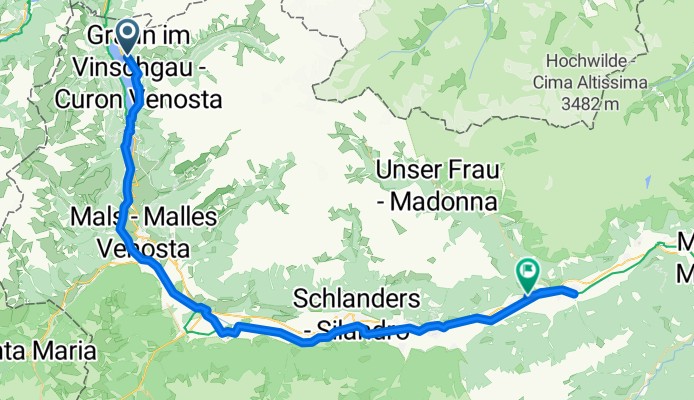
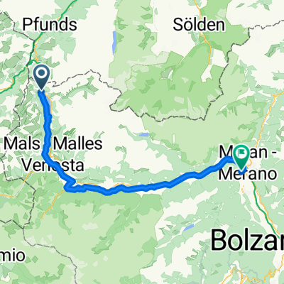
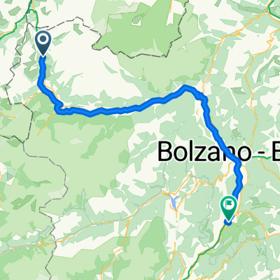
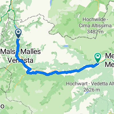
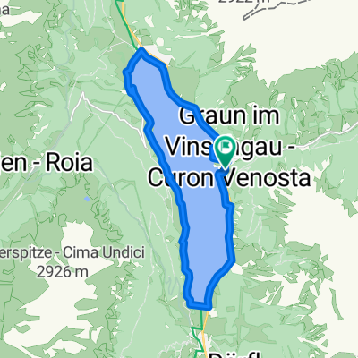
Reschen - Naturns
A cycling route starting in Graun im Vinschgau, Trentino-Alto Adige, Italy.
Overview
About this route
- -:--
- Duration
- 65.4 km
- Distance
- 64 m
- Ascent
- 1,012 m
- Descent
- ---
- Avg. speed
- ---
- Max. altitude
Route quality
Waytypes & surfaces along the route
Waytypes
Cycleway
22.2 km
(34 %)
Quiet road
18.3 km
(28 %)
Surfaces
Paved
57.6 km
(88 %)
Unpaved
7.2 km
(11 %)
Asphalt
57.6 km
(88 %)
Loose gravel
5.9 km
(9 %)
Route highlights
Points of interest along the route
Point of interest after 0 km
start
Point of interest after 61.3 km
ziel
Continue with Bikemap
Use, edit, or download this cycling route
You would like to ride Reschen - Naturns or customize it for your own trip? Here is what you can do with this Bikemap route:
Free features
- Save this route as favorite or in collections
- Copy & plan your own version of this route
- Sync your route with Garmin or Wahoo
Premium features
Free trial for 3 days, or one-time payment. More about Bikemap Premium.
- Navigate this route on iOS & Android
- Export a GPX / KML file of this route
- Create your custom printout (try it for free)
- Download this route for offline navigation
Discover more Premium features.
Get Bikemap PremiumFrom our community
Other popular routes starting in Graun im Vinschgau
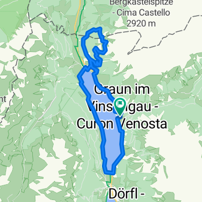 Plamort mit Rischensee Umrundung
- Distance
- 25.5 km
- Ascent
- 1,007 m
- Descent
- 1,006 m
- Location
- Graun im Vinschgau, Trentino-Alto Adige, Italy
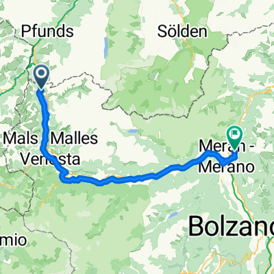 Reschen-Schenna
- Distance
- 87.3 km
- Ascent
- 962 m
- Descent
- 1,907 m
- Location
- Graun im Vinschgau, Trentino-Alto Adige, Italy
 Runde - Reschensee und Heidersee mit lecker Stopp beim Zenner
- Distance
- 22.6 km
- Ascent
- 216 m
- Descent
- 212 m
- Location
- Graun im Vinschgau, Trentino-Alto Adige, Italy
 Prutz - Nauders
- Distance
- 81.7 km
- Ascent
- 770 m
- Descent
- 1,898 m
- Location
- Graun im Vinschgau, Trentino-Alto Adige, Italy
 Melag bis Moseben und zurück mit Gravelbike
- Distance
- 23.6 km
- Ascent
- 689 m
- Descent
- 697 m
- Location
- Graun im Vinschgau, Trentino-Alto Adige, Italy
 Schlanders - San Michele all'Adige
- Distance
- 119.7 km
- Ascent
- 566 m
- Descent
- 1,812 m
- Location
- Graun im Vinschgau, Trentino-Alto Adige, Italy
 Via Chiesa nach Via Stazione
- Distance
- 61.1 km
- Ascent
- 98 m
- Descent
- 1,098 m
- Location
- Graun im Vinschgau, Trentino-Alto Adige, Italy
 Reschenseeumrundung
- Distance
- 16.1 km
- Ascent
- 350 m
- Descent
- 349 m
- Location
- Graun im Vinschgau, Trentino-Alto Adige, Italy
Open it in the app