- 54.3 km
- 1,316 m
- 1,316 m
- Bystra, Silesian Voivodeship, Poland
BB-Wapiennica-Błatnia-Klimczok-KoziaGóra
A cycling route starting in Bystra, Silesian Voivodeship, Poland.
Overview
About this route
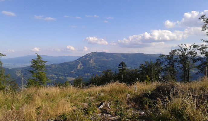
In search of gravel - Silesian Beskids, near Bielsko-Biała. We started the route from the Gypsy Forest, from where we reached the shelter at Dębowiec along wide gravel paths and then to the Krzywa Chata shelter by the dam in Wapiennica. From there, we spontaneously headed down the valley towards Błatnia as best as we could. We reached 100m below the summit and hit a dead end ending in a gully with a river, so we backtracked 50m and took a shortcut steeply uphill, at times carrying our bikes on our backs. Fortunately, we reached a path (that we had abandoned half a kilometer earlier because it was going too far east) and followed it to the official red/yellow trail at the top of the mountain range. Then, we planned to descend to the shelter at Błatnia. Our next goal for the trip was Klimczok, via Trzy Kopce, without bypassing the summit of Klimczok (one could also have gone the black route towards Szyndzielnia and return on the red back to Klimczok). After the descent to the shelter at Klimczok, we entered a overgrown green trail (to the north), more suitable for walking bikes, a very narrow, stony and rooty path traversing the slope. But after less than 300m, it joined a wide gravel path and continued on until the Kołowrót Pass (connecting Szyndzielnia with Kozia Góra). There, we chose the yellow trail to the Kozi Pass and then the black to the trail intersection under Kozia Góra, and then descended to the Gypsy Forest. We could have still climbed to Kozia and descended by Twister, but the day was already rich and fulfilling after this route and distance. Great trip. Squad: Leo and Łoś (15.08.2016)
- -:--
- Duration
- 34.8 km
- Distance
- 989 m
- Ascent
- 987 m
- Descent
- ---
- Avg. speed
- ---
- Max. altitude
created this 9 years ago
Route photos
Continue with Bikemap
Use, edit, or download this cycling route
You would like to ride BB-Wapiennica-Błatnia-Klimczok-KoziaGóra or customize it for your own trip? Here is what you can do with this Bikemap route:
Free features
- Save this route as favorite or in collections
- Copy & plan your own version of this route
- Sync your route with Garmin or Wahoo
Premium features
Free trial for 3 days, or one-time payment. More about Bikemap Premium.
- Navigate this route on iOS & Android
- Export a GPX / KML file of this route
- Create your custom printout (try it for free)
- Download this route for offline navigation
Discover more Premium features.
Get Bikemap PremiumFrom our community
Other popular routes starting in Bystra
- BB-Klimczok-Błatnia-Bystra-Kotarz-ChataWToma-Szczyrk
- Dom szeroka 26 do szczyrku
- 12.7 km
- 182 m
- 27 m
- Bystra, Silesian Voivodeship, Poland
- Rock'n'Roll Trail / EnduroTrails Bielsko-Biała
- 11.7 km
- 376 m
- 636 m
- Bystra, Silesian Voivodeship, Poland
- twister
- 2.2 km
- 0 m
- 168 m
- Bystra, Silesian Voivodeship, Poland
- Klimczok (nowy przejazd) z Młodym 😁 Chilli Santa Cruz Tallboy test 👀
- 30.8 km
- 1,044 m
- 1,041 m
- Bystra, Silesian Voivodeship, Poland
- Klasyk bielski
- 24.2 km
- 904 m
- 888 m
- Bystra, Silesian Voivodeship, Poland
- Przędzalnicza do Kolejowa
- 16.5 km
- 141 m
- 191 m
- Bystra, Silesian Voivodeship, Poland
- MTB Szyndzielnia-Klimczok-Błatnia 14.05.2011
- 23 km
- 822 m
- 822 m
- Bystra, Silesian Voivodeship, Poland
Open it in the app


