

Ciclabile Mur 3
A cycling route starting in Sankt Michael in Obersteiermark, Styria, Austria.
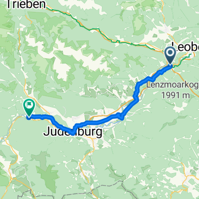
Overview
About this route
02.08.2016: Stage from Sankt Michael to Graz via Leoben, Bruck an der Mur, Frohnleiten
- -:--
- Duration
- 92.5 km
- Distance
- 294 m
- Ascent
- 518 m
- Descent
- ---
- Avg. speed
- ---
- Max. altitude

Route quality
Waytypes & surfaces along the route
Waytypes
Quiet road
39.8 km
(43 %)
Cycleway
22.2 km
(24 %)
Surfaces
Paved
66.6 km
(72 %)
Unpaved
3.7 km
(4 %)
Asphalt
61.1 km
(66 %)
Paved (undefined)
5.6 km
(6 %)
Continue with Bikemap
Use, edit, or download this cycling route
You would like to ride Ciclabile Mur 3 or customize it for your own trip? Here is what you can do with this Bikemap route:
Free features
- Save this route as favorite or in collections
- Copy & plan your own version of this route
- Split it into stages to create a multi-day tour
- Sync your route with Garmin or Wahoo
Premium features
Free trial for 3 days, or one-time payment. More about Bikemap Premium.
- Navigate this route on iOS & Android
- Export a GPX / KML file of this route
- Create your custom printout (try it for free)
- Download this route for offline navigation
Discover more Premium features.
Get Bikemap PremiumFrom our community
Other popular routes starting in Sankt Michael in Obersteiermark
 Raiffeisenstraße nach Stockergasse
- Distance
- 91.1 km
- Ascent
- 761 m
- Descent
- 1,018 m
- Location
- Sankt Michael in Obersteiermark, Styria, Austria
 Itálie 1999 - 10. etapa (7.8.1999) CLONED FROM ROUTE 579432
- Distance
- 217.8 km
- Ascent
- 546 m
- Descent
- 969 m
- Location
- Sankt Michael in Obersteiermark, Styria, Austria
 StMichael-Trattnerhof
- Distance
- 82 km
- Ascent
- 640 m
- Descent
- 437 m
- Location
- Sankt Michael in Obersteiermark, Styria, Austria
 St. Michael, Sankt Michael in der Obersteiermark to Bahnhofstraße 79, Zeltweg
- Distance
- 44.3 km
- Ascent
- 145 m
- Descent
- 121 m
- Location
- Sankt Michael in Obersteiermark, Styria, Austria
 St.Michael i.d. Obersteierm. - Lassing
- Distance
- 73 km
- Ascent
- 397 m
- Descent
- 240 m
- Location
- Sankt Michael in Obersteiermark, Styria, Austria
 Von Sankt Michael in Obersteiermark bis Sankt Georgen ob Judenburg
- Distance
- 61.3 km
- Ascent
- 736 m
- Descent
- 589 m
- Location
- Sankt Michael in Obersteiermark, Styria, Austria
 Raiffeisenstraße 24, Sankt Michael in der Obersteiermark nach Hauptplatz 22, Frohnleiten
- Distance
- 56.3 km
- Ascent
- 467 m
- Descent
- 643 m
- Location
- Sankt Michael in Obersteiermark, Styria, Austria
 Sankt Michael in Obersteiermark nach Peggau
- Distance
- 70.9 km
- Ascent
- 799 m
- Descent
- 970 m
- Location
- Sankt Michael in Obersteiermark, Styria, Austria
Open it in the app