

Ciclabile Mur 6
A cycling route starting in Kotoriba, Međimurje County, Croatia.
Overview
About this route
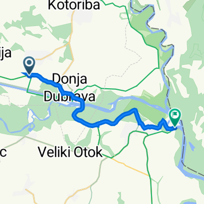
05.08.2016: Stage from Donji Vidovec to Legrad and the confluence of the Mur into the Drava
- -:--
- Duration
- 25.5 km
- Distance
- 32 m
- Ascent
- 35 m
- Descent
- ---
- Avg. speed
- ---
- Max. altitude

Continue with Bikemap
Use, edit, or download this cycling route
You would like to ride Ciclabile Mur 6 or customize it for your own trip? Here is what you can do with this Bikemap route:
Free features
- Save this route as favorite or in collections
- Copy & plan your own version of this route
- Sync your route with Garmin or Wahoo
Premium features
Free trial for 3 days, or one-time payment. More about Bikemap Premium.
- Navigate this route on iOS & Android
- Export a GPX / KML file of this route
- Create your custom printout (try it for free)
- Download this route for offline navigation
Discover more Premium features.
Get Bikemap PremiumFrom our community
Other popular routes starting in Kotoriba
 2020.04. Zalai barangolás 2. nap vissza
- Distance
- 20.2 km
- Ascent
- 117 m
- Descent
- 37 m
- Location
- Kotoriba, Međimurje County, Croatia
 Mur8VSüd: Donji Vidovec - Mursko Sredisce, 64,8km 52hm
- Distance
- 64.8 km
- Ascent
- 52 m
- Descent
- 19 m
- Location
- Kotoriba, Međimurje County, Croatia
 Glavna ulica 79, Donji Vidovec nach Ulica Petra Zrinskog 300, Legrad
- Distance
- 11.6 km
- Ascent
- 71 m
- Descent
- 80 m
- Location
- Kotoriba, Međimurje County, Croatia
 Murafölde túra / Molnári - Őrtilos
- Distance
- 13.7 km
- Ascent
- 34 m
- Descent
- 41 m
- Location
- Kotoriba, Međimurje County, Croatia
 AoE Sv.M.-Oprovec
- Distance
- 7 km
- Ascent
- 4 m
- Descent
- 0 m
- Location
- Kotoriba, Međimurje County, Croatia
 Moderate route
- Distance
- 33.1 km
- Ascent
- 130 m
- Descent
- 119 m
- Location
- Kotoriba, Međimurje County, Croatia
 Donji Vidovec - Goriscnica
- Distance
- 77.6 km
- Ascent
- 117 m
- Descent
- 42 m
- Location
- Kotoriba, Međimurje County, Croatia
 L 18 Zrinska
- Distance
- 32.6 km
- Ascent
- 22 m
- Descent
- 20 m
- Location
- Kotoriba, Međimurje County, Croatia
Open it in the app