

Puszcza Dulowska 2020
A cycling route starting in Tenczynek, Lesser Poland Voivodeship, Poland.
Overview
About this route
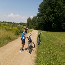
Dulowska Forest from Rudno or Dulowa (loop)
- -:--
- Duration
- 29.1 km
- Distance
- 118 m
- Ascent
- 117 m
- Descent
- ---
- Avg. speed
- ---
- Max. altitude

Route quality
Waytypes & surfaces along the route
Waytypes
Track
17.7 km
(61 %)
Access road
10.5 km
(36 %)
Surfaces
Paved
10.8 km
(37 %)
Unpaved
17.7 km
(61 %)
Asphalt
10.8 km
(37 %)
Loose gravel
7.8 km
(27 %)
Continue with Bikemap
Use, edit, or download this cycling route
You would like to ride Puszcza Dulowska 2020 or customize it for your own trip? Here is what you can do with this Bikemap route:
Free features
- Save this route as favorite or in collections
- Copy & plan your own version of this route
- Sync your route with Garmin or Wahoo
Premium features
Free trial for 3 days, or one-time payment. More about Bikemap Premium.
- Navigate this route on iOS & Android
- Export a GPX / KML file of this route
- Create your custom printout (try it for free)
- Download this route for offline navigation
Discover more Premium features.
Get Bikemap PremiumFrom our community
Other popular routes starting in Tenczynek
 chechlo
- Distance
- 32.4 km
- Ascent
- 242 m
- Descent
- 242 m
- Location
- Tenczynek, Lesser Poland Voivodeship, Poland
 Tenczynek - Rozkochów - Tenczynek
- Distance
- 43.6 km
- Ascent
- 53 m
- Descent
- 161 m
- Location
- Tenczynek, Lesser Poland Voivodeship, Poland
 Tenczynek - Sucha B
- Distance
- 59.3 km
- Ascent
- 740 m
- Descent
- 685 m
- Location
- Tenczynek, Lesser Poland Voivodeship, Poland
 Henryka Sienkiewicza 27, Tenczynek do Księdza Wincentego Smoczyńskiego 2, Tenczynek
- Distance
- 13.1 km
- Ascent
- 164 m
- Descent
- 133 m
- Location
- Tenczynek, Lesser Poland Voivodeship, Poland
 Zielna 18, Tenczynek do Dębowa 7, Wola Filipowska
- Distance
- 41.4 km
- Ascent
- 284 m
- Descent
- 292 m
- Location
- Tenczynek, Lesser Poland Voivodeship, Poland
 2018/17 Lotnisko z Kubą
- Distance
- 45.7 km
- Ascent
- 399 m
- Descent
- 400 m
- Location
- Tenczynek, Lesser Poland Voivodeship, Poland
 Rudno, Tenczynek do Rudno 270, Tenczynek
- Distance
- 29.7 km
- Ascent
- 666 m
- Descent
- 664 m
- Location
- Tenczynek, Lesser Poland Voivodeship, Poland
 Księdza Wincentego Smoczyńskiego 15A, Tenczynek do Księdza Wincentego Smoczyńskiego 15A, Tenczynek
- Distance
- 22.8 km
- Ascent
- 752 m
- Descent
- 749 m
- Location
- Tenczynek, Lesser Poland Voivodeship, Poland
Open it in the app