7-Tage durch West Slowenien
A cycling route starting in Bohinjska Bistrica, Bohinj Municipality, Slovenia.
Overview
About this route
<p>7 days across western Slovenia from <strong>Bohinj</strong> to <strong>Koper</strong>, via Skofia Locka, <strong>Smlednik</strong>, Tehovec, <strong>Ljubljana</strong>, Vrhnika, <strong>Idrija</strong>, Vipava, <strong>Pliskovica</strong>, Sezana, Lipica, <strong>Skoflje</strong>, Hrpeljie, <strong>Podgorje,</strong> Podpec and Sv. Anton.</p>
<p>From Koper, we also made a detour to Portoroz (for swimming) and Piran (a beautiful little town). Due to its proximity to Koper, a detour to Trieste is also possible, which we unfortunately could not take due to lack of time.</p>
<p>The tour was planned as a family vacation (2 families), with pre-booked accommodations (highlighted places). The goal was to get to know the country and the people off the standard routes and ultimately spend a few days by the sea.</p>
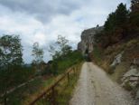
<p>In the first section, it was demanding, with longer sections and some ascents and descents, while in the second section the route is flatter and with shorter stretches towards the destination. The trip was made on mountain bikes and trekking bikes over asphalt, compacted dirt roads, and gravel.</p>
Translated, show original (German)- -:--
- Duration
- 380.6 km
- Distance
- 2,749 m
- Ascent
- 3,287 m
- Descent
- ---
- Avg. speed
- ---
- Max. altitude
Route photos
Route quality
Waytypes & surfaces along the route
Waytypes
Quiet road
133.2 km
(35 %)
Road
95.1 km
(25 %)
Surfaces
Paved
239.8 km
(63 %)
Unpaved
60.9 km
(16 %)
Asphalt
232.2 km
(61 %)
Gravel
45.7 km
(12 %)
Continue with Bikemap
Use, edit, or download this cycling route
You would like to ride 7-Tage durch West Slowenien or customize it for your own trip? Here is what you can do with this Bikemap route:
Free features
- Save this route as favorite or in collections
- Copy & plan your own version of this route
- Split it into stages to create a multi-day tour
- Sync your route with Garmin or Wahoo
Premium features
Free trial for 3 days, or one-time payment. More about Bikemap Premium.
- Navigate this route on iOS & Android
- Export a GPX / KML file of this route
- Create your custom printout (try it for free)
- Download this route for offline navigation
Discover more Premium features.
Get Bikemap PremiumFrom our community
Other popular routes starting in Bohinjska Bistrica
 Bohinjska Bistrica do Bohinjskega jezera in nazaj
- Distance
- 14.8 km
- Ascent
- 253 m
- Descent
- 252 m
- Location
- Bohinjska Bistrica, Bohinj Municipality, Slovenia
 Bohinjska Bistrica do Češnjice, okoli jezera in na slap
- Distance
- 32.5 km
- Ascent
- 332 m
- Descent
- 329 m
- Location
- Bohinjska Bistrica, Bohinj Municipality, Slovenia
 b.b- koprivnik-gorjuse-b.b
- Distance
- 46.6 km
- Ascent
- 888 m
- Descent
- 889 m
- Location
- Bohinjska Bistrica, Bohinj Municipality, Slovenia
 Nad Bohijnským jezerem
- Distance
- 28.7 km
- Ascent
- 843 m
- Descent
- 843 m
- Location
- Bohinjska Bistrica, Bohinj Municipality, Slovenia
 Day 2 Side Trip to Waterfall Savica
- Distance
- 7.8 km
- Ascent
- 239 m
- Descent
- 112 m
- Location
- Bohinjska Bistrica, Bohinj Municipality, Slovenia
 Bohinj-Nova Gorica
- Distance
- 105.8 km
- Ascent
- 4,715 m
- Descent
- 5,135 m
- Location
- Bohinjska Bistrica, Bohinj Municipality, Slovenia
 Along the Shady Hunter's Trail and the Sunny Northern Shore Around Lake Bohinj - Along the Shady Hunter's Trail and the Sunny Northern Shore Around Lake Bohinj
- Distance
- 16.1 km
- Ascent
- 409 m
- Descent
- 410 m
- Location
- Bohinjska Bistrica, Bohinj Municipality, Slovenia
 Stara Fužina - Planina Vogar - Stara Fužina
- Distance
- 20.7 km
- Ascent
- 819 m
- Descent
- 826 m
- Location
- Bohinjska Bistrica, Bohinj Municipality, Slovenia
Open it in the app


