UR, 11.8. - 24.8., Provence, France
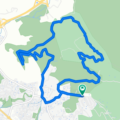
A cycling route starting in Les Pennes-Mirabeau, Provence-Alpes-C么te d'Azur Region, France.
Overview
About this route
- -:--
- Duration
- 623.8 km
- Distance
- 3,607 m
- Ascent
- 3,608 m
- Descent
- ---
- Avg. speed
- ---
- Avg. speed
Route highlights
Points of interest along the route
Accommodation after 2.3 km
13
Accommodation after 2.3 km
1
Accommodation after 41.7 km
2
Accommodation after 93 km
3
Point of interest after 99 km
Perfect swimming conditions, many kajaks
Point of interest after 115.5 km
Very clear, but cold water
Accommodation after 115.8 km
4
Point of interest after 157.7 km
Grand Canyon du Verdon, 8 km hiking round with some climbing parts, swimming in river only partly possible
Accommodation after 175.8 km
5,6; Camping place
Point of interest after 176.6 km
Aiguines, very beautiful city
Point of interest after 195.1 km
Big lavender fields
Accommodation after 197.1 km
7
Point of interest after 229.7 km
Public market with regional specialities
Accommodation after 276.8 km
8
Point of interest after 334.2 km
Biking without backpack to Mont Ventoux, 1911 m
Accommodation after 361.4 km
9, 10; Camping place
Point of interest after 390.5 km
Red sand stone area
Accommodation after 474.9 km
11
Point of interest after 500.4 km
Flamingo site
Point of interest after 520.6 km
Very nice beach, many kite surfers
Accommodation after 538.7 km
12
Continue with Bikemap
Use, edit, or download this cycling route
You would like to ride UR, 11.8. - 24.8., Provence, France or customize it for your own trip? Here is what you can do with this Bikemap route:
Free features
- Save this route as favorite or in collections
- Copy & plan your own version of this route
- Sync your route with Garmin or Wahoo
Premium features
Free trial for 3 days, or one-time payment. More about Bikemap Premium.
- Navigate this route on iOS & Android
- Export a GPX / KML file of this route
- Create your custom printout (try it for free)
- Download this route for offline navigation
Discover more Premium features.
Get Bikemap PremiumFrom our community
Other popular routes starting in Les Pennes-Mirabeau
- UR, 11.8. - 24.8., Provence, France
- Distance
- 623.8 km
- Ascent
- 3,607 m
- Descent
- 3,608 m
- Location
- Les Pennes-Mirabeau, Provence-Alpes-C么te d'Azur Region, France
- Les Pennes - Calanque Everine
- Distance
- 41.4 km
- Ascent
- 629 m
- Descent
- 629 m
- Location
- Les Pennes-Mirabeau, Provence-Alpes-C么te d'Azur Region, France
- Victoria-Canyons
- Distance
- 9.1 km
- Ascent
- 137 m
- Descent
- 137 m
- Location
- Les Pennes-Mirabeau, Provence-Alpes-C么te d'Azur Region, France
- Les Pennes Centre - Fort de Niolon
- Distance
- 30.5 km
- Ascent
- 421 m
- Descent
- 412 m
- Location
- Les Pennes-Mirabeau, Provence-Alpes-C么te d'Azur Region, France
- 190815_randoHenri
- Distance
- 98.1 km
- Ascent
- 877 m
- Descent
- 878 m
- Location
- Les Pennes-Mirabeau, Provence-Alpes-C么te d'Azur Region, France
- Plan des Pennes - Porte des calanques
- Distance
- 18.6 km
- Ascent
- 282 m
- Descent
- 284 m
- Location
- Les Pennes-Mirabeau, Provence-Alpes-C么te d'Azur Region, France
- Les Pennes - Fort de Niolon
- Distance
- 36.5 km
- Ascent
- 541 m
- Descent
- 541 m
- Location
- Les Pennes-Mirabeau, Provence-Alpes-C么te d'Azur Region, France
- Pennes-Rove
- Distance
- 27 km
- Ascent
- 577 m
- Descent
- 577 m
- Location
- Les Pennes-Mirabeau, Provence-Alpes-C么te d'Azur Region, France
Open it in the app