
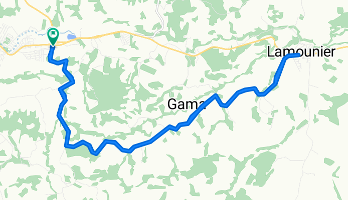
Itapecerica-MG to Lamounier
A cycling route starting in Itapecerica, Minas Gerais, Brazil.
Overview
About this route
- -:--
- Duration
- 25.2 km
- Distance
- 284 m
- Ascent
- 282 m
- Descent
- ---
- Avg. speed
- ---
- Max. altitude
Route photos

Route quality
Waytypes & surfaces along the route
Waytypes
Quiet road
24.7 km
(98 %)
Busy road
0.5 km
(2 %)
Undefined
-0 km
(<1 %)
Continue with Bikemap
Use, edit, or download this cycling route
You would like to ride Itapecerica-MG to Lamounier or customize it for your own trip? Here is what you can do with this Bikemap route:
Free features
- Save this route as favorite or in collections
- Copy & plan your own version of this route
- Sync your route with Garmin or Wahoo
Premium features
Free trial for 3 days, or one-time payment. More about Bikemap Premium.
- Navigate this route on iOS & Android
- Export a GPX / KML file of this route
- Create your custom printout (try it for free)
- Download this route for offline navigation
Discover more Premium features.
Get Bikemap PremiumFrom our community
Other popular routes starting in Itapecerica
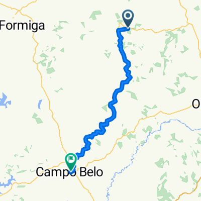 2 NOVO HOTEL Itapecerica - Campo Belo 2021
- Distance
- 79.2 km
- Ascent
- 1,757 m
- Descent
- 1,732 m
- Location
- Itapecerica, Minas Gerais, Brazil
 Itapecerica-MG to Lamounier
- Distance
- 25.2 km
- Ascent
- 284 m
- Descent
- 282 m
- Location
- Itapecerica, Minas Gerais, Brazil
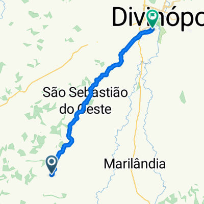 De Unnamed Road a Rua Guapé 650
- Distance
- 33.6 km
- Ascent
- 638 m
- Descent
- 677 m
- Location
- Itapecerica, Minas Gerais, Brazil
Open it in the app