

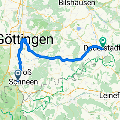
Groß Schneen/Gleichen Waldtour 42,7km/640hm
A cycling route starting in Gemeinde Friedland, Lower Saxony, Germany.
Overview
About this route
Groß Schneen Dreisch Reinhausen Lichtenhagen Waldschlößchen Gleichen Appenrode Lichtenhagen Reiffenhausen Bocksbühl Groß Schneen
- -:--
- Duration
- 42.8 km
- Distance
- 681 m
- Ascent
- 681 m
- Descent
- ---
- Avg. speed
- ---
- Max. altitude

Route quality
Waytypes & surfaces along the route
Waytypes
Track
34.7 km
(81 %)
Quiet road
3.5 km
(8 %)
Surfaces
Paved
13.9 km
(32 %)
Unpaved
28.7 km
(67 %)
Gravel
20 km
(47 %)
Asphalt
9 km
(21 %)
Continue with Bikemap
Use, edit, or download this cycling route
You would like to ride Groß Schneen/Gleichen Waldtour 42,7km/640hm or customize it for your own trip? Here is what you can do with this Bikemap route:
Free features
- Save this route as favorite or in collections
- Copy & plan your own version of this route
- Sync your route with Garmin or Wahoo
Premium features
Free trial for 3 days, or one-time payment. More about Bikemap Premium.
- Navigate this route on iOS & Android
- Export a GPX / KML file of this route
- Create your custom printout (try it for free)
- Download this route for offline navigation
Discover more Premium features.
Get Bikemap PremiumFrom our community
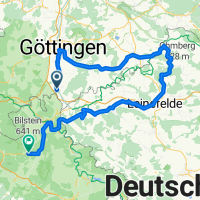
Other popular routes starting in Gemeinde Friedland
 Groß Schneen 34,5km MTB--Tour
- Distance
- 35.1 km
- Ascent
- 646 m
- Descent
- 646 m
- Location
- Gemeinde Friedland, Lower Saxony, Germany
 Burg Hanstein-Schloß Berlepsch 44,6 km
- Distance
- 44.7 km
- Ascent
- 676 m
- Descent
- 676 m
- Location
- Gemeinde Friedland, Lower Saxony, Germany
 Habichtsstein
- Distance
- 61.8 km
- Ascent
- 763 m
- Descent
- 763 m
- Location
- Gemeinde Friedland, Lower Saxony, Germany
 Eichsfeld-Werratal-Hainich-Unstrut-Runde
- Distance
- 134.6 km
- Ascent
- 1,060 m
- Descent
- 1,060 m
- Location
- Gemeinde Friedland, Lower Saxony, Germany
 Melli_1
- Distance
- 139.2 km
- Ascent
- 1,558 m
- Descent
- 1,350 m
- Location
- Gemeinde Friedland, Lower Saxony, Germany
 Groß Schneen - Billingshausen
- Distance
- 31.4 km
- Ascent
- 413 m
- Descent
- 390 m
- Location
- Gemeinde Friedland, Lower Saxony, Germany
 Friedland- Frankenberg
- Distance
- 126.2 km
- Ascent
- 1,080 m
- Descent
- 992 m
- Location
- Gemeinde Friedland, Lower Saxony, Germany
 Melli25_T1
- Distance
- 48.1 km
- Ascent
- 292 m
- Descent
- 286 m
- Location
- Gemeinde Friedland, Lower Saxony, Germany
Open it in the app