

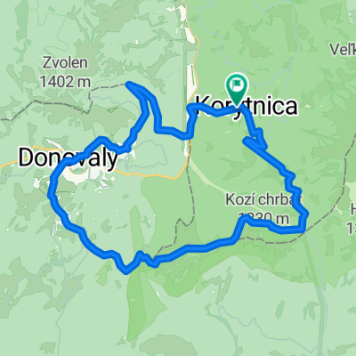
Rovinka... Suchy vrch-Podlavice-Riecka-Riec. sedlo-Ravasky-Pod vysielacom-Hamor
A cycling route starting in Banská Bystrica, Banská Bystrica Region, Slovakia.
Overview
About this route
- 2 h 24 min
- Duration
- 18 km
- Distance
- 504 m
- Ascent
- 811 m
- Descent
- 7.5 km/h
- Avg. speed
- ---
- Max. altitude
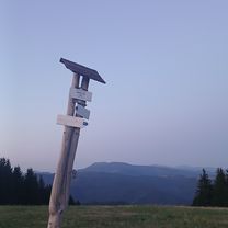
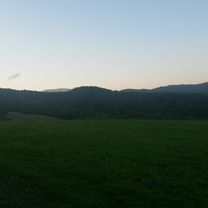
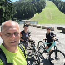
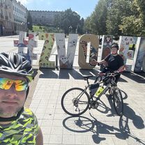
Route photos


Route highlights
Points of interest along the route
Point of interest after 9.6 km
Nad Riecko
Continue with Bikemap
Use, edit, or download this cycling route
You would like to ride Rovinka... Suchy vrch-Podlavice-Riecka-Riec. sedlo-Ravasky-Pod vysielacom-Hamor or customize it for your own trip? Here is what you can do with this Bikemap route:
Free features
- Save this route as favorite or in collections
- Copy & plan your own version of this route
- Sync your route with Garmin or Wahoo
Premium features
Free trial for 3 days, or one-time payment. More about Bikemap Premium.
- Navigate this route on iOS & Android
- Export a GPX / KML file of this route
- Create your custom printout (try it for free)
- Download this route for offline navigation
Discover more Premium features.
Get Bikemap PremiumFrom our community
Other popular routes starting in Banská Bystrica
 Riecanske sedlo
- Distance
- 10.4 km
- Ascent
- 432 m
- Descent
- 435 m
- Location
- Banská Bystrica, Banská Bystrica Region, Slovakia
 Selce do Špania Dolina
- Distance
- 2.3 km
- Ascent
- 154 m
- Descent
- 69 m
- Location
- Banská Bystrica, Banská Bystrica Region, Slovakia
 1011_Výhľady pod Kozím
- Distance
- 23 km
- Ascent
- 814 m
- Descent
- 816 m
- Location
- Banská Bystrica, Banská Bystrica Region, Slovakia
 Rovinka... Suchy vrch-Podlavice-Riecka-Riec. sedlo-Ravasky-Pod vysielacom-Hamor
- Distance
- 18 km
- Ascent
- 504 m
- Descent
- 811 m
- Location
- Banská Bystrica, Banská Bystrica Region, Slovakia
 Senická cesta, Podkonice, Moštenica, Šachticky do Senická cesta 38
- Distance
- 48 km
- Ascent
- 1,330 m
- Descent
- 1,334 m
- Location
- Banská Bystrica, Banská Bystrica Region, Slovakia
 Vlkanová - Malachov - Banská Bystrica
- Distance
- 19 km
- Ascent
- 511 m
- Descent
- 446 m
- Location
- Banská Bystrica, Banská Bystrica Region, Slovakia
 Kráľová, Banská Bystrica až Zvolenská cesta, Banská Bystrica
- Distance
- 49.1 km
- Ascent
- 212 m
- Descent
- 212 m
- Location
- Banská Bystrica, Banská Bystrica Region, Slovakia
 Tatranská 6 do Tatranská 86
- Distance
- 13.3 km
- Ascent
- 553 m
- Descent
- 499 m
- Location
- Banská Bystrica, Banská Bystrica Region, Slovakia
Open it in the app