

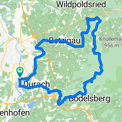
Kempten - Comer See
A cycling route starting in Durach, Bavaria, Germany.
Overview
About this route
Rennrad - Alpencross: Kempten - Oberjoch - Hahntenjoch - Piller Höhe - Reschenpass - Umbrail - Abfahrt Stilfserjoch - Meran - Molveno See - Riva(Gardasee)
4 Etappen ca. Einteilungen:
-
Kempten - Imst (Oberjoch, Hahntenjoch)
-
Imst - Taufers (Pillerhöhe, Reschenpass)
-
Taufers - Naturns (Umbrail, Abfahrt Stiflserjoch)
-
Naturs - Riva (Molveno)
- -:--
- Duration
- 441.4 km
- Distance
- 4,859 m
- Ascent
- 5,498 m
- Descent
- ---
- Avg. speed
- ---
- Max. altitude
Route quality
Waytypes & surfaces along the route
Waytypes
Busy road
135.7 km
(31 %)
Quiet road
84.2 km
(19 %)
Surfaces
Paved
315.7 km
(72 %)
Unpaved
78.8 km
(18 %)
Asphalt
305.3 km
(69 %)
Unpaved (undefined)
42.3 km
(10 %)
Continue with Bikemap
Use, edit, or download this cycling route
You would like to ride Kempten - Comer See or customize it for your own trip? Here is what you can do with this Bikemap route:
Free features
- Save this route as favorite or in collections
- Copy & plan your own version of this route
- Split it into stages to create a multi-day tour
- Sync your route with Garmin or Wahoo
Premium features
Free trial for 3 days, or one-time payment. More about Bikemap Premium.
- Navigate this route on iOS & Android
- Export a GPX / KML file of this route
- Create your custom printout (try it for free)
- Download this route for offline navigation
Discover more Premium features.
Get Bikemap PremiumFrom our community
Other popular routes starting in Durach
 Rottach-Speicher-Grünten-Runde
- Distance
- 54.4 km
- Ascent
- 542 m
- Descent
- 543 m
- Location
- Durach, Bavaria, Germany
 Kemptener Wald
- Distance
- 27.9 km
- Ascent
- 357 m
- Descent
- 357 m
- Location
- Durach, Bavaria, Germany
 Runde um den Rottachspeicher
- Distance
- 56.4 km
- Ascent
- 493 m
- Descent
- 488 m
- Location
- Durach, Bavaria, Germany
 Grüntenrunde
- Distance
- 58.9 km
- Ascent
- 1,151 m
- Descent
- 1,157 m
- Location
- Durach, Bavaria, Germany
 grosse runde
- Distance
- 158 km
- Ascent
- 1,931 m
- Descent
- 1,868 m
- Location
- Durach, Bavaria, Germany
 Südliches Kempten Allgäu Route
- Distance
- 58 km
- Ascent
- 470 m
- Descent
- 489 m
- Location
- Durach, Bavaria, Germany
 Familienrundweg Durach-Martinzell an der Iller entlang
- Distance
- 27.6 km
- Ascent
- 112 m
- Descent
- 114 m
- Location
- Durach, Bavaria, Germany
 Kemptener Wald
- Distance
- 35.7 km
- Ascent
- 387 m
- Descent
- 385 m
- Location
- Durach, Bavaria, Germany
Open it in the app