

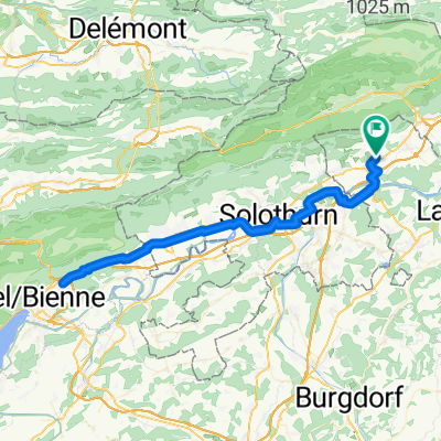
Aarerunde
A cycling route starting in Oberbipp, Canton of Bern, Switzerland.
Overview
About this route
- -:--
- Duration
- 30.3 km
- Distance
- 206 m
- Ascent
- 203 m
- Descent
- ---
- Avg. speed
- ---
- Max. altitude
Route quality
Waytypes & surfaces along the route
Waytypes
Track
14.5 km
(48 %)
Quiet road
8.5 km
(28 %)
Surfaces
Paved
13.9 km
(46 %)
Unpaved
14.5 km
(48 %)
Asphalt
13.9 km
(46 %)
Gravel
10.9 km
(36 %)
Route highlights
Points of interest along the route
Point of interest after 14.9 km
Singletrail
Point of interest after 17.4 km
Singletrail
Continue with Bikemap
Use, edit, or download this cycling route
You would like to ride Aarerunde or customize it for your own trip? Here is what you can do with this Bikemap route:
Free features
- Save this route as favorite or in collections
- Copy & plan your own version of this route
- Sync your route with Garmin or Wahoo
Premium features
Free trial for 3 days, or one-time payment. More about Bikemap Premium.
- Navigate this route on iOS & Android
- Export a GPX / KML file of this route
- Create your custom printout (try it for free)
- Download this route for offline navigation
Discover more Premium features.
Get Bikemap PremiumFrom our community
Other popular routes starting in Oberbipp
 Bikerunde von Oberbipp auf den Balmberg
- Distance
- 26.3 km
- Ascent
- 771 m
- Descent
- 768 m
- Location
- Oberbipp, Canton of Bern, Switzerland
 Kirchgasse 1B, Oberbipp nach Wasen im Emmental
- Distance
- 40.4 km
- Ascent
- 715 m
- Descent
- 397 m
- Location
- Oberbipp, Canton of Bern, Switzerland
 Hasenweg 2, Oberbipp nach Oeschstrasse 5, Subingen
- Distance
- 9.9 km
- Ascent
- 50 m
- Descent
- 121 m
- Location
- Oberbipp, Canton of Bern, Switzerland
 Oltenstrasse 23A, Oberbipp nach Chänzeliweg, Hägendorf
- Distance
- 46.3 km
- Ascent
- 303 m
- Descent
- 410 m
- Location
- Oberbipp, Canton of Bern, Switzerland
 AAreroute
- Distance
- 21.9 km
- Ascent
- 176 m
- Descent
- 178 m
- Location
- Oberbipp, Canton of Bern, Switzerland
 Steingasse 28, Oberbipp nach Hauptgasse 66, Solothurn
- Distance
- 12.1 km
- Ascent
- 72 m
- Descent
- 113 m
- Location
- Oberbipp, Canton of Bern, Switzerland
 Sägetweg 18, Oberbipp nach Hauptstrasse 47–49, Solothurn
- Distance
- 20.4 km
- Ascent
- 144 m
- Descent
- 196 m
- Location
- Oberbipp, Canton of Bern, Switzerland
 Weihergasse, Oberbipp nach Weihergasse, Oberbipp
- Distance
- 81.9 km
- Ascent
- 397 m
- Descent
- 390 m
- Location
- Oberbipp, Canton of Bern, Switzerland
Open it in the app