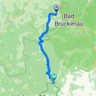
Zeitlofs - Rieneck
- 45.4 km
- 462 m
- 628 m
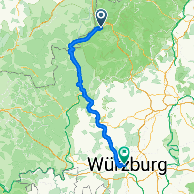
- Bad Brückenau, Bavaria, Germany
A cycling route starting in Bad Brückenau, Bavaria, Germany.
Overview
With the trekking bike – a mix of aesthetics and pragmatism, there are country roads included, although there surely would have been bike paths everywhere that would have accompanied every conceivable meter of elevation on the side.
created this 9 years ago
Route quality
Quiet road
24.3 km
(20 %)
Track
20.6 km
(17 %)
Paved
85 km
(70 %)
Unpaved
12.1 km
(10 %)
Asphalt
81.3 km
(67 %)
Gravel
10.9 km
(9 %)
Continue with Bikemap
You would like to ride Bad Brückenau - Frankfurt-Seckbach or customize it for your own trip? Here is what you can do with this Bikemap route:
Free trial for 3 days, or one-time payment. More about Bikemap Premium.
Discover more Premium features.
Get Bikemap PremiumFrom our community
Open it in the app