

Tour Gójar Otura Dílar
A cycling route starting in Gójar, Andalusia, Spain.
Overview
About this route
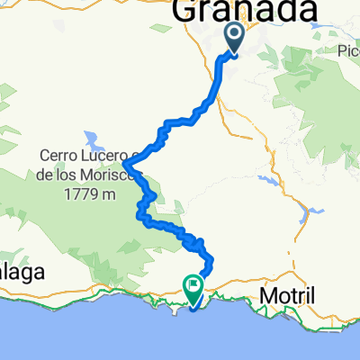
Ruta por caminos asfaltados y tierra, rodeando el pueblo de Dílar.
- -:--
- Duration
- 19.2 km
- Distance
- 274 m
- Ascent
- 193 m
- Descent
- ---
- Avg. speed
- 983 m
- Max. altitude

Route quality
Waytypes & surfaces along the route
Waytypes
Track
8.7 km
(45 %)
Quiet road
6.6 km
(35 %)
Surfaces
Paved
3.9 km
(20 %)
Unpaved
4.7 km
(25 %)
Gravel
4.2 km
(22 %)
Asphalt
2.5 km
(13 %)
Continue with Bikemap
Use, edit, or download this cycling route
You would like to ride Tour Gójar Otura Dílar or customize it for your own trip? Here is what you can do with this Bikemap route:
Free features
- Save this route as favorite or in collections
- Copy & plan your own version of this route
- Sync your route with Garmin or Wahoo
Premium features
Free trial for 3 days, or one-time payment. More about Bikemap Premium.
- Navigate this route on iOS & Android
- Export a GPX / KML file of this route
- Create your custom printout (try it for free)
- Download this route for offline navigation
Discover more Premium features.
Get Bikemap PremiumFrom our community
Other popular routes starting in Gójar
 subida al collado del fraile barrancohondao 2012
- Distance
- 27.1 km
- Ascent
- 819 m
- Descent
- 553 m
- Location
- Gójar, Andalusia, Spain
 LOMA LINDA - ALMUÑECAR
- Distance
- 89.9 km
- Ascent
- 1,344 m
- Descent
- 2,088 m
- Location
- Gójar, Andalusia, Spain
 Tour Gójar Otura Dílar
- Distance
- 19.2 km
- Ascent
- 274 m
- Descent
- 193 m
- Location
- Gójar, Andalusia, Spain
 Rio Dílar
- Distance
- 25.6 km
- Ascent
- 870 m
- Descent
- 803 m
- Location
- Gójar, Andalusia, Spain
 De Gójar al rio Dílar
- Distance
- 21 km
- Ascent
- 340 m
- Descent
- 393 m
- Location
- Gójar, Andalusia, Spain
 Ogijares - Hermita Vieja
- Distance
- 28 km
- Ascent
- 763 m
- Descent
- 668 m
- Location
- Gójar, Andalusia, Spain
 Gójar Armilla Granada Pinos Genil
- Distance
- 46.7 km
- Ascent
- 301 m
- Descent
- 302 m
- Location
- Gójar, Andalusia, Spain
 Granada - Salobreña
- Distance
- 86.8 km
- Ascent
- 1,071 m
- Descent
- 1,812 m
- Location
- Gójar, Andalusia, Spain
Open it in the app