

Rotorua-MtMaunganui
A cycling route starting in Auckland, Auckland, New Zealand.
Overview
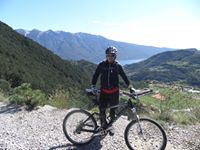
About this route
Čím více zde napíšete informací, tím více bude užitečnější pro ostatním uživatele.<br /><br />* Průběh trasy.<br />* Co je zvláštní na této trase?<br />* Proč doporučit tuto trasu?<br />* Co se Vám zde nejvíce líbilo?<br />* Atd.
- -:--
- Duration
- 35.7 km
- Distance
- 308 m
- Ascent
- 273 m
- Descent
- ---
- Avg. speed
- 106 m
- Max. altitude
Route quality
Waytypes & surfaces along the route
Waytypes
Busy road
16.4 km
(46 %)
Quiet road
7.3 km
(20 %)
Surfaces
Paved
33.9 km
(95 %)
Asphalt
27.6 km
(77 %)
Concrete
3.5 km
(10 %)
Continue with Bikemap
Use, edit, or download this cycling route
You would like to ride Rotorua-MtMaunganui or customize it for your own trip? Here is what you can do with this Bikemap route:
Free features
- Save this route as favorite or in collections
- Copy & plan your own version of this route
- Sync your route with Garmin or Wahoo
Premium features
Free trial for 3 days, or one-time payment. More about Bikemap Premium.
- Navigate this route on iOS & Android
- Export a GPX / KML file of this route
- Create your custom printout (try it for free)
- Download this route for offline navigation
Discover more Premium features.
Get Bikemap PremiumFrom our community
Other popular routes starting in Auckland
 Point England, Panmure Basin Loop, Meadowbank Cycleway
- Distance
- 24.8 km
- Ascent
- 0 m
- Descent
- 0 m
- Location
- Auckland, Auckland, New Zealand
 Tamaki Drive, Westhaven Marina, Harbour Bridge - One way
- Distance
- 18.7 km
- Ascent
- 234 m
- Descent
- 235 m
- Location
- Auckland, Auckland, New Zealand
 Point England, Panmure Basin loop
- Distance
- 26.4 km
- Ascent
- 262 m
- Descent
- 260 m
- Location
- Auckland, Auckland, New Zealand
 Point England, Panmure Basin, Mt Wellington, Waiatarua Wetlands
- Distance
- 24.3 km
- Ascent
- 310 m
- Descent
- 309 m
- Location
- Auckland, Auckland, New Zealand
 North-Western bike path, Grey Lynn Park, Cox's Bay Reserve, Viaduct, Tamaki Drive
- Distance
- 24.3 km
- Ascent
- 182 m
- Descent
- 166 m
- Location
- Auckland, Auckland, New Zealand
 Ellerslie to Pukekohe
- Distance
- 137.8 km
- Ascent
- 390 m
- Descent
- 390 m
- Location
- Auckland, Auckland, New Zealand
 Taking the Onya for a spin in Auckland
- Distance
- 25.2 km
- Ascent
- 99 m
- Descent
- 91 m
- Location
- Auckland, Auckland, New Zealand
 Auckland - Whangarei par le nord
- Distance
- 580.2 km
- Ascent
- 1,575 m
- Descent
- 1,594 m
- Location
- Auckland, Auckland, New Zealand
Open it in the app