

Niepołomice - Szarów - Kłaj - Poszyna - Niepolomice
A cycling route starting in Niepołomice, Lesser Poland Voivodeship, Poland.
Overview
About this route
We start in the center and head down Bocheńska Street towards the parking lot and the bike path towards Szarów and Kłaj. After reaching Kłaj, we head toward the railway station and the second (I think) largest water reservoir in the forest.
Next, we go toward Sitowiec. There we can spend some time at the cemetery from World War I and the Oak of King Stefan Batory.
Then, following the signs, we have 5 km left to return to the Castle in Niepołomice.
- -:--
- Duration
- 18.7 km
- Distance
- 72 m
- Ascent
- 76 m
- Descent
- ---
- Avg. speed
- ---
- Max. altitude

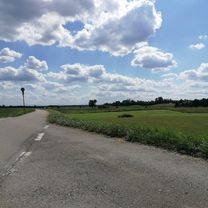
Route photos


Continue with Bikemap
Use, edit, or download this cycling route
You would like to ride Niepołomice - Szarów - Kłaj - Poszyna - Niepolomice or customize it for your own trip? Here is what you can do with this Bikemap route:
Free features
- Save this route as favorite or in collections
- Copy & plan your own version of this route
- Sync your route with Garmin or Wahoo
Premium features
Free trial for 3 days, or one-time payment. More about Bikemap Premium.
- Navigate this route on iOS & Android
- Export a GPX / KML file of this route
- Create your custom printout (try it for free)
- Download this route for offline navigation
Discover more Premium features.
Get Bikemap PremiumFrom our community
Other popular routes starting in Niepołomice
 Niepołomice do Pałacu Żeleńskich
- Distance
- 25.3 km
- Ascent
- 169 m
- Descent
- 171 m
- Location
- Niepołomice, Lesser Poland Voivodeship, Poland
 Śladami I wojny światowej
- Distance
- 55.5 km
- Ascent
- 505 m
- Descent
- 499 m
- Location
- Niepołomice, Lesser Poland Voivodeship, Poland
 Dookoła Krakowa
- Distance
- 111.4 km
- Ascent
- 347 m
- Descent
- 346 m
- Location
- Niepołomice, Lesser Poland Voivodeship, Poland
 Puszcza Niepolomicka
- Distance
- 11.9 km
- Ascent
- 231 m
- Descent
- 233 m
- Location
- Niepołomice, Lesser Poland Voivodeship, Poland
 Niepołomice
- Distance
- 63.4 km
- Ascent
- 455 m
- Descent
- 458 m
- Location
- Niepołomice, Lesser Poland Voivodeship, Poland
 Niepolomice-55 km
- Distance
- 54.2 km
- Ascent
- 125 m
- Descent
- 124 m
- Location
- Niepołomice, Lesser Poland Voivodeship, Poland
 Puszcza Niepołomicka 1
- Distance
- 26.7 km
- Ascent
- 81 m
- Descent
- 81 m
- Location
- Niepołomice, Lesser Poland Voivodeship, Poland
 Niepołomice - Przypasek Rusiecki
- Distance
- 16.3 km
- Ascent
- 423 m
- Descent
- 477 m
- Location
- Niepołomice, Lesser Poland Voivodeship, Poland
Open it in the app