

Okinawa Day2
A cycling route starting in Nago, Okinawa, Japan.
Overview
About this route
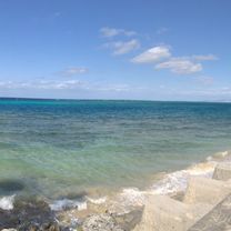
水族館廝混~出發
預計經古宇立大橋
到達國頭村
- -:--
- Duration
- 47.9 km
- Distance
- 168 m
- Ascent
- 231 m
- Descent
- ---
- Avg. speed
- ---
- Max. altitude
Continue with Bikemap
Use, edit, or download this cycling route
You would like to ride Okinawa Day2 or customize it for your own trip? Here is what you can do with this Bikemap route:
Free features
- Save this route as favorite or in collections
- Copy & plan your own version of this route
- Sync your route with Garmin or Wahoo
Premium features
Free trial for 3 days, or one-time payment. More about Bikemap Premium.
- Navigate this route on iOS & Android
- Export a GPX / KML file of this route
- Create your custom printout (try it for free)
- Download this route for offline navigation
Discover more Premium features.
Get Bikemap PremiumFrom our community
Other popular routes starting in Nago
 23/12 那霸 》瀨底島
- Distance
- 25.8 km
- Ascent
- 103 m
- Descent
- 64 m
- Location
- Nago, Okinawa, Japan
 沖繩環島 Day 4
- Distance
- 80.8 km
- Ascent
- 1,022 m
- Descent
- 1,087 m
- Location
- Nago, Okinawa, Japan
 環沖繩 - 2
- Distance
- 183.4 km
- Ascent
- 961 m
- Descent
- 950 m
- Location
- Nago, Okinawa, Japan
 沖繩環島 Day 4 Adjusted
- Distance
- 58.4 km
- Ascent
- 780 m
- Descent
- 846 m
- Location
- Nago, Okinawa, Japan
 沖繩環島 Day 5
- Distance
- 63.3 km
- Ascent
- 1,007 m
- Descent
- 968 m
- Location
- Nago, Okinawa, Japan
 Tour de Okinawa 2017 (100km)
- Distance
- 96.3 km
- Ascent
- 667 m
- Descent
- 670 m
- Location
- Nago, Okinawa, Japan
 Okinawa Bike Day2
- Distance
- 71.5 km
- Ascent
- 430 m
- Descent
- 436 m
- Location
- Nago, Okinawa, Japan
 2015.07.09-13沖繩環島五天四夜
- Distance
- 340.3 km
- Ascent
- 860 m
- Descent
- 866 m
- Location
- Nago, Okinawa, Japan
Open it in the app