Rundstrecke - Altenglan
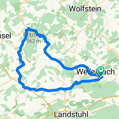
A cycling route starting in Rodenbach, Rhineland-Palatinate, Germany.
Overview
About this route
Loop route: Ride clockwise or counterclockwise
KL-Einsiedlerhof - Industrial area Start and Finish 9.0 km. Start > Weilerbach 7 km, Schwedelbach 10 km, Reichenbach-Steegen 15 km, Oberstaufenbach 17.5 km. Niederstaufenb.19.5 km, Friedelhausen 22 km, Altenglan 26km Return via Steinwenden: Wolfsgraben 28 km, Remigiusberg 30 km, Gimsbach 32.5 km. Glan-Münchweiler 37 km, Niedermohr 40 km, Steinwenden 44.5 km, Miesenbach 46.5 km, Rodenbach roundabout 53.5 km. End "Militärstraße" 58 km. Plus KL-Start and Finish-KL 18 km. Total 76 km.
- -:--
- Duration
- 58.8 km
- Distance
- 227 m
- Ascent
- 228 m
- Descent
- ---
- Avg. speed
- ---
- Max. altitude
Route quality
Waytypes & surfaces along the route
Waytypes
Track
13.5 km
(23 %)
Road
10.6 km
(18 %)
Surfaces
Paved
48.8 km
(83 %)
Unpaved
1.2 km
(2 %)
Asphalt
42.3 km
(72 %)
Paved (undefined)
6.5 km
(11 %)
Route highlights
Points of interest along the route
Point of interest after 33.1 km
Einsiedlerhof Von Millerstr.> Weilerbach > Strecke Bike In > Oberstaufenb.> Niederstaufenb. > Altenglan bis Bahnhof 26,5 km. Oder über > Einsiedlerhof, Von Millerstr. > Rodenbach > Miesenbach > Obermohr > Niedermohr > Matzenbach > Altenglan bis Bahnhof 32,5km. Rundkurs 59 km
Continue with Bikemap
Use, edit, or download this cycling route
You would like to ride Rundstrecke - Altenglan or customize it for your own trip? Here is what you can do with this Bikemap route:
Free features
- Save this route as favorite or in collections
- Copy & plan your own version of this route
- Sync your route with Garmin or Wahoo
Premium features
Free trial for 3 days, or one-time payment. More about Bikemap Premium.
- Navigate this route on iOS & Android
- Export a GPX / KML file of this route
- Create your custom printout (try it for free)
- Download this route for offline navigation
Discover more Premium features.
Get Bikemap PremiumFrom our community
Other popular routes starting in Rodenbach
Tour Ohmbach- Distance
- 69.6 km
- Ascent
- 388 m
- Descent
- 386 m
- Location
- Rodenbach, Rhineland-Palatinate, Germany
Tour Hüffler- Distance
- 73.9 km
- Ascent
- 602 m
- Descent
- 606 m
- Location
- Rodenbach, Rhineland-Palatinate, Germany
Tour Neuhemsbach- Distance
- 72.6 km
- Ascent
- 443 m
- Descent
- 446 m
- Location
- Rodenbach, Rhineland-Palatinate, Germany
Tour zum Donnersberg - Imsbach- Distance
- 63.9 km
- Ascent
- 467 m
- Descent
- 472 m
- Location
- Rodenbach, Rhineland-Palatinate, Germany
Hausstrecke - Burg Nanstein etc- Distance
- 37.9 km
- Ascent
- 348 m
- Descent
- 350 m
- Location
- Rodenbach, Rhineland-Palatinate, Germany
Am Schlagbaum, Rodenbach nach Am Schlagbaum, Rodenbach- Distance
- 17 km
- Ascent
- 139 m
- Descent
- 138 m
- Location
- Rodenbach, Rhineland-Palatinate, Germany
AADWF- Distance
- 33.3 km
- Ascent
- 355 m
- Descent
- 342 m
- Location
- Rodenbach, Rhineland-Palatinate, Germany
Rodenbach, Dahner Felsenland, Rodenbach- Distance
- 168.2 km
- Ascent
- 1,115 m
- Descent
- 1,115 m
- Location
- Rodenbach, Rhineland-Palatinate, Germany
Open it in the app


