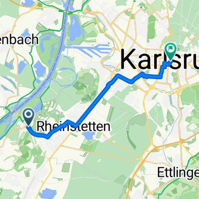
Badische Eröffnungsfahrt - RTF des RSV Concordia 1920 Forchheim e.V. - 54 km Strecke
- 54.2 km
- 152 m
- 149 m
- Rheinstetten, Baden-Wurttemberg, Germany
A cycling route starting in Rheinstetten, Baden-Wurttemberg, Germany.
Overview
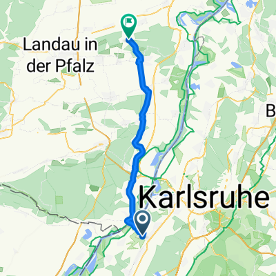
from Karlsruhe via long-distance bike paths to Flensburg
created this 9 years ago
Route quality
Track
367.6 km
(33 %)
Quiet road
256.2 km
(23 %)
Paved
857.8 km
(77 %)
Unpaved
111.4 km
(10 %)
Asphalt
779.8 km
(70 %)
Gravel
66.8 km
(6 %)
Route highlights
Veysel Home
1. Übernachtung
Home Eltern Thomas
3. Übernachtung
4. Übernachtung
5. Übernachtung
6. Übernachtung
7. Übernachtung
Continue with Bikemap
You would like to ride KA-Flensburg or customize it for your own trip? Here is what you can do with this Bikemap route:
Free trial for 3 days, or one-time payment. More about Bikemap Premium.
Discover more Premium features.
Get Bikemap PremiumFrom our community
Open it in the app