- 19.1 km
- 121 m
- 120 m
- Alcobendas, Madrid, Spain
Alcobendas - Soto - Guadalix - Colmenar - Alcobendas
A cycling route starting in Alcobendas, Madrid, Spain.
Overview
About this route
Option A: Alcobendas - Soto - Guadalix - Colmenar via the hill - Alcobendas
Option B: Alcobendas - Soto - Guadalix - Colmenar via Rancajales - Alcobendas
Option C: Alcobendas - Soto - Alcobendas
Reunion at the bike lane Colmenar
- -:--
- Duration
- 77.8 km
- Distance
- 567 m
- Ascent
- 567 m
- Descent
- ---
- Avg. speed
- ---
- Max. altitude
created this 9 years ago
Route quality
Waytypes & surfaces along the route
Waytypes
Cycleway
52.2 km
(67 %)
Road
1.6 km
(2 %)
Surfaces
Paved
32.7 km
(42 %)
Unpaved
0.8 km
(1 %)
Asphalt
29.6 km
(38 %)
Concrete
3.1 km
(4 %)
Continue with Bikemap
Use, edit, or download this cycling route
You would like to ride Alcobendas - Soto - Guadalix - Colmenar - Alcobendas or customize it for your own trip? Here is what you can do with this Bikemap route:
Free features
- Save this route as favorite or in collections
- Copy & plan your own version of this route
- Sync your route with Garmin or Wahoo
Premium features
Free trial for 3 days, or one-time payment. More about Bikemap Premium.
- Navigate this route on iOS & Android
- Export a GPX / KML file of this route
- Create your custom printout (try it for free)
- Download this route for offline navigation
Discover more Premium features.
Get Bikemap PremiumFrom our community
Other popular routes starting in Alcobendas
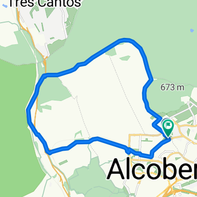
- Alcobendas to Madrid
- Calle del Iris, Alcobendas a Calle del Iris, Alcobendas
- 45.7 km
- 423 m
- 434 m
- Alcobendas, Madrid, Spain
- Paseo rápido en Alcobendas
- 9.9 km
- 162 m
- 187 m
- Alcobendas, Madrid, Spain
- Alcobendas - Soto - Rancajales - Alcobendas
- 66.8 km
- 497 m
- 498 m
- Alcobendas, Madrid, Spain
- Avenida de Bruselas, Alcobendas to Calle de María Reiche, Madrid
- 38.4 km
- 357 m
- 359 m
- Alcobendas, Madrid, Spain
- Calle del Maestro Barbieri, Alcobendas a Calle del Maestro Barbieri, Alcobendas
- 20.7 km
- 328 m
- 333 m
- Alcobendas, Madrid, Spain
- Canencia-rancajales
- 105.4 km
- 1,162 m
- 1,157 m
- Alcobendas, Madrid, Spain
- ruta por la sierra madrileña
- 134.4 km
- 1,825 m
- 1,812 m
- Alcobendas, Madrid, Spain
Open it in the app


