

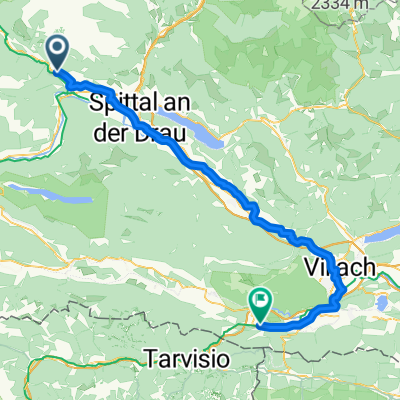
Göriacher Alm
A cycling route starting in Mühldorf, Carinthia, Austria.
Overview
About this route
TEASI Track
- -:--
- Duration
- 17.6 km
- Distance
- 904 m
- Ascent
- 908 m
- Descent
- ---
- Avg. speed
- ---
- Max. altitude
Continue with Bikemap
Use, edit, or download this cycling route
You would like to ride Göriacher Alm or customize it for your own trip? Here is what you can do with this Bikemap route:
Free features
- Save this route as favorite or in collections
- Copy & plan your own version of this route
- Sync your route with Garmin or Wahoo
Premium features
Free trial for 3 days, or one-time payment. More about Bikemap Premium.
- Navigate this route on iOS & Android
- Export a GPX / KML file of this route
- Create your custom printout (try it for free)
- Download this route for offline navigation
Discover more Premium features.
Get Bikemap PremiumFrom our community
Other popular routes starting in Mühldorf
 Kärntnerseen Tour 00 Gesamtübersicht
- Distance
- 208.1 km
- Ascent
- 340 m
- Descent
- 342 m
- Location
- Mühldorf, Carinthia, Austria
 Berlin_Praga
- Distance
- 5,087.7 km
- Ascent
- 1,498 m
- Descent
- 1,924 m
- Location
- Mühldorf, Carinthia, Austria
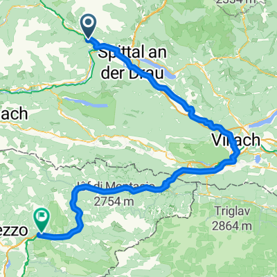
 Mühldorf - Arnoldstein
- Distance
- 72.7 km
- Ascent
- 593 m
- Descent
- 607 m
- Location
- Mühldorf, Carinthia, Austria
 Alpen Day 5 Mühldorf to Villach
- Distance
- 64.7 km
- Ascent
- 390 m
- Descent
- 465 m
- Location
- Mühldorf, Carinthia, Austria
 Drau/Muhr Runde 01
- Distance
- 48.6 km
- Ascent
- 387 m
- Descent
- 204 m
- Location
- Mühldorf, Carinthia, Austria
 Göriacher Alm
- Distance
- 17.6 km
- Ascent
- 904 m
- Descent
- 908 m
- Location
- Mühldorf, Carinthia, Austria
 Alpen Südseite 01
- Distance
- 142.7 km
- Ascent
- 990 m
- Descent
- 456 m
- Location
- Mühldorf, Carinthia, Austria
 Mühldorf - Moggio di Sotto
- Distance
- 134.5 km
- Ascent
- 1,805 m
- Descent
- 2,081 m
- Location
- Mühldorf, Carinthia, Austria
Open it in the app