

2012 - Colombie-Britannique - Jour 5
A cycling route starting in Cache Creek, British Columbia, Canada.
Overview
About this route
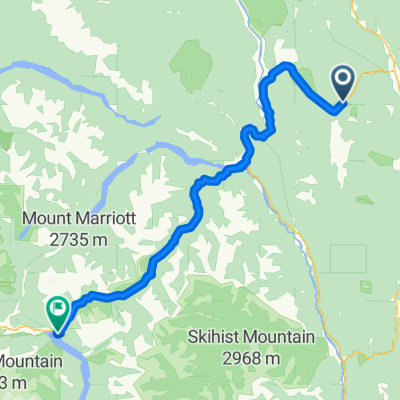
Day 5 of my trip from Vancouver to Calgary
- -:--
- Duration
- 83.8 km
- Distance
- 897 m
- Ascent
- 977 m
- Descent
- ---
- Avg. speed
- ---
- Max. altitude

Continue with Bikemap
Use, edit, or download this cycling route
You would like to ride 2012 - Colombie-Britannique - Jour 5 or customize it for your own trip? Here is what you can do with this Bikemap route:
Free features
- Save this route as favorite or in collections
- Copy & plan your own version of this route
- Split it into stages to create a multi-day tour
- Sync your route with Garmin or Wahoo
Premium features
Free trial for 3 days, or one-time payment. More about Bikemap Premium.
- Navigate this route on iOS & Android
- Export a GPX / KML file of this route
- Create your custom printout (try it for free)
- Download this route for offline navigation
Discover more Premium features.
Get Bikemap PremiumFrom our community
Other popular routes starting in Cache Creek
 fsdfsdfsdf
- Distance
- 180.1 km
- Ascent
- 2,802 m
- Descent
- 2,012 m
- Location
- Cache Creek, British Columbia, Canada
 Cache Creek - Pemberton
- Distance
- 141.1 km
- Ascent
- 839 m
- Descent
- 1,482 m
- Location
- Cache Creek, British Columbia, Canada
 h44g #1
- Distance
- 205.1 km
- Ascent
- 2,178 m
- Descent
- 2,016 m
- Location
- Cache Creek, British Columbia, Canada
 Cache Creek to Kamloops
- Distance
- 77.5 km
- Ascent
- 798 m
- Descent
- 602 m
- Location
- Cache Creek, British Columbia, Canada
 (04) Cache Creek - Kamloops
- Distance
- 86.3 km
- Ascent
- 889 m
- Descent
- 1,002 m
- Location
- Cache Creek, British Columbia, Canada
 very steep climb
- Distance
- 114.9 km
- Ascent
- 1,203 m
- Descent
- 1,090 m
- Location
- Cache Creek, British Columbia, Canada
 Cache Creek to Kamloops
- Distance
- 98.8 km
- Ascent
- 1,164 m
- Descent
- 1,274 m
- Location
- Cache Creek, British Columbia, Canada
 2012 - Colombie-Britannique - Jour 5
- Distance
- 83.8 km
- Ascent
- 897 m
- Descent
- 977 m
- Location
- Cache Creek, British Columbia, Canada
Open it in the app