
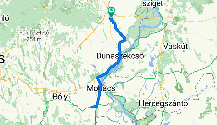
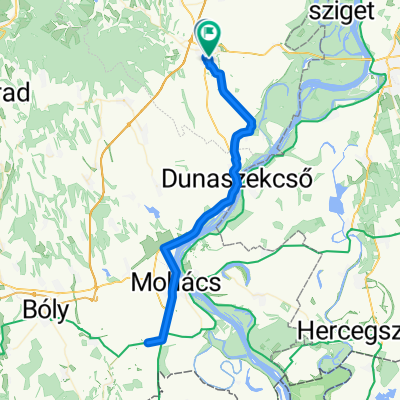
Bátaszék-Mohács vonaltúra
A cycling route starting in Bátaszék, Tolna County, Hungary.
Overview
About this route
Memorial site of the Battle of Mohács near the border of Sátorhely.
- -:--
- Duration
- 74.3 km
- Distance
- 175 m
- Ascent
- 175 m
- Descent
- ---
- Avg. speed
- ---
- Max. altitude
Route quality
Waytypes & surfaces along the route
Waytypes
Cycleway
18.6 km
(25 %)
Quiet road
17.1 km
(23 %)
Surfaces
Paved
32 km
(43 %)
Unpaved
6.7 km
(9 %)
Asphalt
23 km
(31 %)
Concrete
8.9 km
(12 %)
Continue with Bikemap
Use, edit, or download this cycling route
You would like to ride Bátaszék-Mohács vonaltúra or customize it for your own trip? Here is what you can do with this Bikemap route:
Free features
- Save this route as favorite or in collections
- Copy & plan your own version of this route
- Sync your route with Garmin or Wahoo
Premium features
Free trial for 3 days, or one-time payment. More about Bikemap Premium.
- Navigate this route on iOS & Android
- Export a GPX / KML file of this route
- Create your custom printout (try it for free)
- Download this route for offline navigation
Discover more Premium features.
Get Bikemap PremiumFrom our community
Other popular routes starting in Bátaszék
 Utánpótlás, Master időfutam bajnokság 2013
- Distance
- 14.7 km
- Ascent
- 12 m
- Descent
- 13 m
- Location
- Bátaszék, Tolna County, Hungary
 Kövesd kör maradtunk volna otthon
- Distance
- 7.7 km
- Ascent
- 134 m
- Descent
- 134 m
- Location
- Bátaszék, Tolna County, Hungary
 Bátaszék-Mohács-Baja
- Distance
- 99.2 km
- Ascent
- 103 m
- Descent
- 106 m
- Location
- Bátaszék, Tolna County, Hungary
 Bátaszék-Mohács vonaltúra
- Distance
- 74.3 km
- Ascent
- 175 m
- Descent
- 175 m
- Location
- Bátaszék, Tolna County, Hungary
 talpa
talpa- Distance
- 36.6 km
- Ascent
- 528 m
- Descent
- 293 m
- Location
- Bátaszék, Tolna County, Hungary
 pécsi túra by vika
- Distance
- 123.1 km
- Ascent
- 804 m
- Descent
- 806 m
- Location
- Bátaszék, Tolna County, Hungary
 Kövesd karika MTB
- Distance
- 46.1 km
- Ascent
- 977 m
- Descent
- 1,008 m
- Location
- Bátaszék, Tolna County, Hungary
 5603 28, Mórágy - Kismórágyi út 26, Mórágy
- Distance
- 27.2 km
- Ascent
- 48 m
- Descent
- 91 m
- Location
- Bátaszék, Tolna County, Hungary
Open it in the app