

Walddorf - Gruorn
A cycling route starting in Altenriet, Baden-Württemberg, Germany.
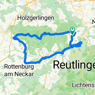
Overview
About this route
anspruchvolle Tour für ausdauernde Fahrer.
Sehr schlechter Radweg vonm Truppenübungsplatz Richtung Seeburg
- -:--
- Duration
- 119.2 km
- Distance
- 814 m
- Ascent
- 813 m
- Descent
- ---
- Avg. speed
- ---
- Max. altitude

Route quality
Waytypes & surfaces along the route
Waytypes
Quiet road
32.5 km
(27 %)
Track
32.2 km
(27 %)
Surfaces
Paved
100.6 km
(84 %)
Unpaved
10.1 km
(8 %)
Asphalt
96.6 km
(81 %)
Gravel
7.8 km
(7 %)
Continue with Bikemap
Use, edit, or download this cycling route
You would like to ride Walddorf - Gruorn or customize it for your own trip? Here is what you can do with this Bikemap route:
Free features
- Save this route as favorite or in collections
- Copy & plan your own version of this route
- Split it into stages to create a multi-day tour
- Sync your route with Garmin or Wahoo
Premium features
Free trial for 3 days, or one-time payment. More about Bikemap Premium.
- Navigate this route on iOS & Android
- Export a GPX / KML file of this route
- Create your custom printout (try it for free)
- Download this route for offline navigation
Discover more Premium features.
Get Bikemap PremiumFrom our community
Other popular routes starting in Altenriet
 Kleine Schönbuch-Runde mit Alb-Blick
- Distance
- 33.9 km
- Ascent
- 508 m
- Descent
- 475 m
- Location
- Altenriet, Baden-Württemberg, Germany
 Walddorf - Mössingen retour
- Distance
- 67.4 km
- Ascent
- 632 m
- Descent
- 627 m
- Location
- Altenriet, Baden-Württemberg, Germany
 Sommertour durch den Schönbuch
- Distance
- 54.4 km
- Ascent
- 289 m
- Descent
- 397 m
- Location
- Altenriet, Baden-Württemberg, Germany
 Pfrondorfer Hölle
- Distance
- 56.2 km
- Ascent
- 264 m
- Descent
- 265 m
- Location
- Altenriet, Baden-Württemberg, Germany
 Rundreise Walddorfhäslach - Gruorn
- Distance
- 88.7 km
- Ascent
- 751 m
- Descent
- 751 m
- Location
- Altenriet, Baden-Württemberg, Germany
 Walddorf - Plattenhardt (samtec) Variante 1
- Distance
- 13.2 km
- Ascent
- 234 m
- Descent
- 217 m
- Location
- Altenriet, Baden-Württemberg, Germany
 Walddorf - Bebenhausen - Mittelstadt
- Distance
- 44.8 km
- Ascent
- 303 m
- Descent
- 305 m
- Location
- Altenriet, Baden-Württemberg, Germany
 Walddorf - Schönbuch - Wurmlingen - Rundtour
- Distance
- 72 km
- Ascent
- 477 m
- Descent
- 554 m
- Location
- Altenriet, Baden-Württemberg, Germany
Open it in the app