

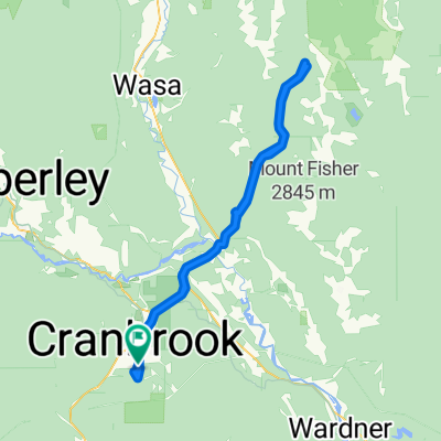
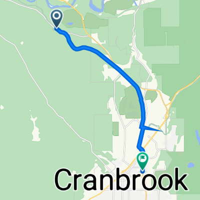
2013 - Colombie-Britannique - Jour 28
A cycling route starting in Cranbrook, British Columbia, Canada.
Overview
About this route
Jour 28 de mon voyage de Abbotsford à Kelowna
- -:--
- Duration
- 89.9 km
- Distance
- 286 m
- Ascent
- 635 m
- Descent
- ---
- Avg. speed
- ---
- Max. altitude

Route quality
Waytypes & surfaces along the route
Waytypes
Cycleway
74.6 km
(83 %)
Quiet road
10.8 km
(12 %)
Surfaces
Paved
25.2 km
(28 %)
Unpaved
1.8 km
(2 %)
Asphalt
13.5 km
(15 %)
Paved (undefined)
11.7 km
(13 %)
Continue with Bikemap
Use, edit, or download this cycling route
You would like to ride 2013 - Colombie-Britannique - Jour 28 or customize it for your own trip? Here is what you can do with this Bikemap route:
Free features
- Save this route as favorite or in collections
- Copy & plan your own version of this route
- Split it into stages to create a multi-day tour
- Sync your route with Garmin or Wahoo
Premium features
Free trial for 3 days, or one-time payment. More about Bikemap Premium.
- Navigate this route on iOS & Android
- Export a GPX / KML file of this route
- Create your custom printout (try it for free)
- Download this route for offline navigation
Discover more Premium features.
Get Bikemap PremiumFrom our community
Other popular routes starting in Cranbrook
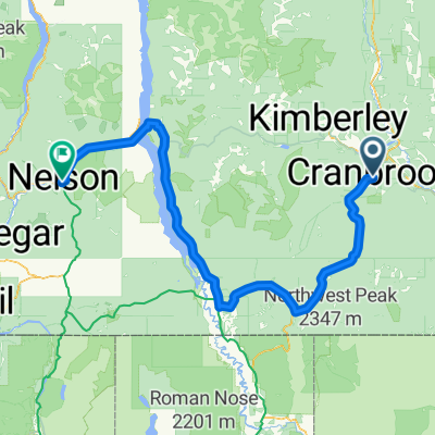
 Interm (proposed) regional cycle route Cranbrook to Kimberly, BC
- Distance
- 27.8 km
- Ascent
- 370 m
- Descent
- 147 m
- Location
- Cranbrook, British Columbia, Canada
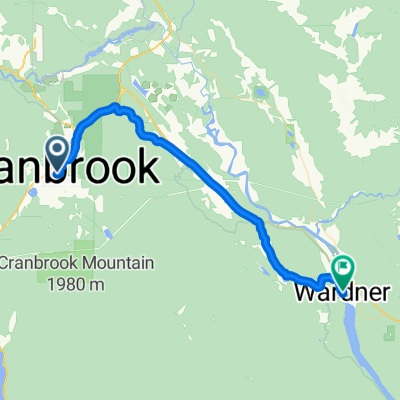 Trans Canada Trail/Route Cranbrook Pavilion to Wardner Provincial Park
- Distance
- 38.1 km
- Ascent
- 107 m
- Descent
- 279 m
- Location
- Cranbrook, British Columbia, Canada
 NOT USED!!! Canada Day 18B: Cranbrook to Creston to Nelson
- Distance
- 231.9 km
- Ascent
- 545 m
- Descent
- 930 m
- Location
- Cranbrook, British Columbia, Canada
 wildhorse fsr
- Distance
- 103.6 km
- Ascent
- 1,510 m
- Descent
- 1,511 m
- Location
- Cranbrook, British Columbia, Canada
 hgjhvv
- Distance
- 8.9 km
- Ascent
- 75 m
- Descent
- 68 m
- Location
- Cranbrook, British Columbia, Canada
 Option 2 Cranbrook -Creston
- Distance
- 109.5 km
- Ascent
- 437 m
- Descent
- 708 m
- Location
- Cranbrook, British Columbia, Canada
 Recovered Route
- Distance
- 36.6 km
- Ascent
- 424 m
- Descent
- 435 m
- Location
- Cranbrook, British Columbia, Canada
 18 55+ Road Race Course
- Distance
- 13.6 km
- Ascent
- 152 m
- Descent
- 152 m
- Location
- Cranbrook, British Columbia, Canada
Open it in the app