

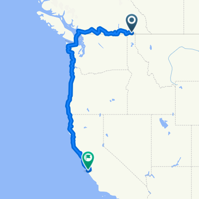
2013 - Colombie-Britannique - Jour 29
A cycling route starting in Creston, British Columbia, Canada.
Overview
About this route
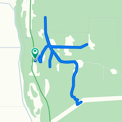
Day 29 of my trip from Abbotsford to Kelowna
- -:--
- Duration
- 123.5 km
- Distance
- 1,553 m
- Ascent
- 1,546 m
- Descent
- ---
- Avg. speed
- ---
- Max. altitude

Route quality
Waytypes & surfaces along the route
Waytypes
Cycleway
76.6 km
(62 %)
Quiet road
8.6 km
(7 %)
Surfaces
Paved
55.6 km
(45 %)
Unpaved
3.7 km
(3 %)
Asphalt
55.6 km
(45 %)
Unpaved (undefined)
2.5 km
(2 %)
Continue with Bikemap
Use, edit, or download this cycling route
You would like to ride 2013 - Colombie-Britannique - Jour 29 or customize it for your own trip? Here is what you can do with this Bikemap route:
Free features
- Save this route as favorite or in collections
- Copy & plan your own version of this route
- Split it into stages to create a multi-day tour
- Sync your route with Garmin or Wahoo
Premium features
Free trial for 3 days, or one-time payment. More about Bikemap Premium.
- Navigate this route on iOS & Android
- Export a GPX / KML file of this route
- Create your custom printout (try it for free)
- Download this route for offline navigation
Discover more Premium features.
Get Bikemap PremiumFrom our community
Other popular routes starting in Creston
 Creston Loop 1
- Distance
- 117.7 km
- Ascent
- 570 m
- Descent
- 504 m
- Location
- Creston, British Columbia, Canada
 Creston-Kimberley
- Distance
- 137.8 km
- Ascent
- 901 m
- Descent
- 331 m
- Location
- Creston, British Columbia, Canada
 gsdfgsdfgsdfg
- Distance
- 192.5 km
- Ascent
- 2,338 m
- Descent
- 2,263 m
- Location
- Creston, British Columbia, Canada
 Cranbrook
- Distance
- 178.3 km
- Ascent
- 1,842 m
- Descent
- 1,540 m
- Location
- Creston, British Columbia, Canada
 Nelson to Creston via Kootnay Ferry Hwy 3A One-Way
- Distance
- 148.5 km
- Ascent
- ---
- Descent
- ---
- Location
- Creston, British Columbia, Canada
 Lakeview-Arrow Creek Rd, Central Kootenay to Lakeview-Arrow Creek Rd, Central Kootenay
- Distance
- 11.8 km
- Ascent
- 329 m
- Descent
- 327 m
- Location
- Creston, British Columbia, Canada
 Creston-Monterey
- Distance
- 2,941.9 km
- Ascent
- 4,256 m
- Descent
- 4,788 m
- Location
- Creston, British Columbia, Canada
 Canada
- Distance
- 40.6 km
- Ascent
- 429 m
- Descent
- 176 m
- Location
- Creston, British Columbia, Canada
Open it in the app