

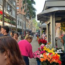
Medellin - Alto de Palmas
A cycling route starting in Medellín, Antioquia, Colombia.
Overview
About this route
Stage 1
- -:--
- Duration
- 16.7 km
- Distance
- 1,090 m
- Ascent
- 51 m
- Descent
- ---
- Avg. speed
- ---
- Max. altitude

Continue with Bikemap
Use, edit, or download this cycling route
You would like to ride Medellin - Alto de Palmas or customize it for your own trip? Here is what you can do with this Bikemap route:
Free features
- Save this route as favorite or in collections
- Copy & plan your own version of this route
- Sync your route with Garmin or Wahoo
Premium features
Free trial for 3 days, or one-time payment. More about Bikemap Premium.
- Navigate this route on iOS & Android
- Export a GPX / KML file of this route
- Create your custom printout (try it for free)
- Download this route for offline navigation
Discover more Premium features.
Get Bikemap PremiumFrom our community
Other popular routes starting in Medellín
 Carrera 51, Medellín a Calle 47, Medellín
- Distance
- 4 km
- Ascent
- 63 m
- Descent
- 46 m
- Location
- Medellín, Antioquia, Colombia
 MDE - Las palmas (up)
- Distance
- 34.5 km
- Ascent
- 1,246 m
- Descent
- 586 m
- Location
- Medellín, Antioquia, Colombia
 De Carrera 83A 32-15, Medellín a Carrera 83A #32b-80, Medellín
- Distance
- 6.7 km
- Ascent
- 140 m
- Descent
- 118 m
- Location
- Medellín, Antioquia, Colombia
 ruta próxima
- Distance
- 67.4 km
- Ascent
- 1,077 m
- Descent
- 1,078 m
- Location
- Medellín, Antioquia, Colombia
 50TH CELEBRATION 200 KMS
- Distance
- 224.8 km
- Ascent
- 2,611 m
- Descent
- 2,616 m
- Location
- Medellín, Antioquia, Colombia
 De Calle 32 # 80-15, Medellín a Calle 32 # 80-15, Medellín
- Distance
- 45.2 km
- Ascent
- 1,102 m
- Descent
- 1,114 m
- Location
- Medellín, Antioquia, Colombia
 La Clara
- Distance
- 67.9 km
- Ascent
- 801 m
- Descent
- 757 m
- Location
- Medellín, Antioquia, Colombia
 Medellin La Pintada
- Distance
- 78.5 km
- Ascent
- 1,123 m
- Descent
- 2,010 m
- Location
- Medellín, Antioquia, Colombia
Open it in the app