- 32.2 km
- 742 m
- 727 m
- Béjar, Castille and León, Spain
Béjar-Hervás-Jerte-Barco de Ávila-Bejar-Candelario
A cycling route starting in Béjar, Castille and León, Spain.
Overview
About this route
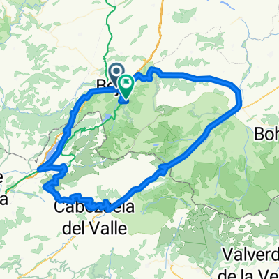
Route through Salamanca and Ávila. We start from Béjar heading towards Puerto de Béjar and Hervás, where we will take the Puerto de Honduras that will lead us to the Jerte Valley. The descent from Honduras will link with the climb to Tornavacas, a road that takes us to El Barco de Ávila. There we will turn towards Béjar and then look for the N-630. Once we enter Béjar and just after crossing the bridge over the Cuerpo de Hombre river, we will turn left to start a small ascent that will take us to the beautiful village of Candelario, where we will finish our route.
- -:--
- Duration
- 120.7 km
- Distance
- 2,083 m
- Ascent
- 1,931 m
- Descent
- ---
- Avg. speed
- ---
- Max. altitude
created this 9 years ago
Route quality
Waytypes & surfaces along the route
Waytypes
Cycleway
37.4 km
(31 %)
Road
30.2 km
(25 %)
Surfaces
Paved
66.4 km
(55 %)
Unpaved
1.2 km
(1 %)
Asphalt
62.8 km
(52 %)
Paved (undefined)
3.6 km
(3 %)
Continue with Bikemap
Use, edit, or download this cycling route
You would like to ride Béjar-Hervás-Jerte-Barco de Ávila-Bejar-Candelario or customize it for your own trip? Here is what you can do with this Bikemap route:
Free features
- Save this route as favorite or in collections
- Copy & plan your own version of this route
- Split it into stages to create a multi-day tour
- Sync your route with Garmin or Wahoo
Premium features
Free trial for 3 days, or one-time payment. More about Bikemap Premium.
- Navigate this route on iOS & Android
- Export a GPX / KML file of this route
- Create your custom printout (try it for free)
- Download this route for offline navigation
Discover more Premium features.
Get Bikemap PremiumFrom our community
Other popular routes starting in Béjar
- Béjar - Los Pinos - Candelario - Cancho la Muela - Llano Alto - Béjar
- Béjar- Ruta Heidi y Vía Verde
- 77.6 km
- 1,425 m
- 1,421 m
- Béjar, Castille and León, Spain
- Béjar-Hervás-Jerte-Barco de Ávila-Bejar-Candelario
- 120.7 km
- 2,083 m
- 1,931 m
- Béjar, Castille and León, Spain
- Bejar-Peña de Francia
- 68.2 km
- 1,463 m
- 774 m
- Béjar, Castille and León, Spain
- Béjar - Presa Navamuño - Cancho de la Muela - Candelario - Alto de los Pollos - Béjar
- 34.9 km
- 699 m
- 700 m
- Béjar, Castille and León, Spain
- Béjar - Navacarros - San Bartolo - Sorihuela - Vallejera - Navacarros - Béjar
- 29.8 km
- 698 m
- 699 m
- Béjar, Castille and León, Spain
- Béjar 1
- 82.2 km
- 2,185 m
- 2,174 m
- Béjar, Castille and León, Spain
- Béjar - Llano Alto - Pantano Navamuño - Candelario - Los Pinos - Béjar
- 18.6 km
- 470 m
- 467 m
- Béjar, Castille and León, Spain
Open it in the app


