
RB 2016 - day 3
A cycling route starting in Baligród, Subcarpathian Voivodeship, Poland.
Overview
About this route
Rajd Bankowca 2016 - Bieszczady
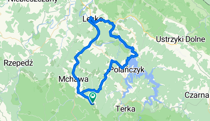
Stężnica - Baligród - Bereźnica Wyżna - Berezka - Myczków - Solina - Myczkowce - Glinne - Lesko - Hoczew - Baligród - Stężnica
- -:--
- Duration
- 66.7 km
- Distance
- 702 m
- Ascent
- 704 m
- Descent
- ---
- Avg. speed
- ---
- Max. altitude
Route quality
Waytypes & surfaces along the route
Waytypes
Road
18 km
(27 %)
Quiet road
8 km
(12 %)
Surfaces
Paved
52 km
(78 %)
Unpaved
2 km
(3 %)
Asphalt
47.4 km
(71 %)
Paved (undefined)
4.7 km
(7 %)
Continue with Bikemap
Use, edit, or download this cycling route
You would like to ride RB 2016 - day 3 or customize it for your own trip? Here is what you can do with this Bikemap route:
Free features
- Save this route as favorite or in collections
- Copy & plan your own version of this route
- Sync your route with Garmin or Wahoo
Premium features
Free trial for 3 days, or one-time payment. More about Bikemap Premium.
- Navigate this route on iOS & Android
- Export a GPX / KML file of this route
- Create your custom printout (try it for free)
- Download this route for offline navigation
Discover more Premium features.
Get Bikemap PremiumFrom our community
Other popular routes starting in Baligród
 W koło Lipowca. Stężnica
- Distance
- 9.2 km
- Ascent
- 323 m
- Descent
- 314 m
- Location
- Baligród, Subcarpathian Voivodeship, Poland
 Bieszczady_24
- Distance
- 25.3 km
- Ascent
- 393 m
- Descent
- 413 m
- Location
- Baligród, Subcarpathian Voivodeship, Poland
 bieszczady_2012
- Distance
- 33 km
- Ascent
- 858 m
- Descent
- 861 m
- Location
- Baligród, Subcarpathian Voivodeship, Poland
 Mchawa - Jeziorko Bobrowe - Baligrod - Mchawa
- Distance
- 26.1 km
- Ascent
- 399 m
- Descent
- 407 m
- Location
- Baligród, Subcarpathian Voivodeship, Poland
 Jabłonki-Baligród-Solina-Lesko-Brzozów-Rzeszów dzień 3
- Distance
- 153.5 km
- Ascent
- 676 m
- Descent
- 1,013 m
- Location
- Baligród, Subcarpathian Voivodeship, Poland
 RB 2016 - day1
- Distance
- 44.9 km
- Ascent
- 532 m
- Descent
- 532 m
- Location
- Baligród, Subcarpathian Voivodeship, Poland
 Chryszczata
- Distance
- 48.4 km
- Ascent
- 938 m
- Descent
- 938 m
- Location
- Baligród, Subcarpathian Voivodeship, Poland
 Bieszczady zachodnie - Wysoki Dział - Beskid Niski
- Distance
- 62.1 km
- Ascent
- 1,861 m
- Descent
- 1,861 m
- Location
- Baligród, Subcarpathian Voivodeship, Poland
Open it in the app