

TRANSPYR
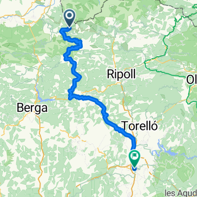
A cycling route starting in Toses, Catalonia, Spain.
Overview
About this route
- -:--
- Duration
- 590 km
- Distance
- 4,585 m
- Ascent
- 6,014 m
- Descent
- ---
- Avg. speed
- ---
- Max. altitude

Route highlights
Points of interest along the route
Accommodation after 52.3 km
Abergue y parada
Point of interest after 57.6 km
PUERTO MONTAÑA
Point of interest after 82.3 km
Acaba puerto
Accommodation after 103.1 km
Parada y fonda
Point of interest after 103.6 km
Pension les colladas
Point of interest after 162.9 km
PUERTO MONTAÑA
Point of interest after 188.5 km
ACABA PUERTO
Point of interest after 201.1 km
Albergue pajaro loco 30e
Point of interest after 248.9 km
PUERTO MONTAÑA
Point of interest after 277.1 km
ACABA PUERTO
Accommodation after 343.2 km
Albergue escuelas pias
Point of interest after 403.9 km
PUERTO MONTAÑA
Point of interest after 415.6 km
ACABA PUERTO
Point of interest after 448.3 km
PUERTO MONTAÑA
Point of interest after 461.7 km
ACABA PUERTO
Accommodation after 487 km
Dormir camping urrobi
Point of interest after 508 km
DERECHA CAMPEON
Point of interest after 531.2 km
BAJADA HASTA IRUN CAMPEON
Accommodation after 584.1 km
Hotel Aitana Descanso y a casa.
Continue with Bikemap
Use, edit, or download this cycling route
You would like to ride TRANSPYR or customize it for your own trip? Here is what you can do with this Bikemap route:
Free features
- Save this route as favorite or in collections
- Copy & plan your own version of this route
- Split it into stages to create a multi-day tour
- Sync your route with Garmin or Wahoo
Premium features
Free trial for 3 days, or one-time payment. More about Bikemap Premium.
- Navigate this route on iOS & Android
- Export a GPX / KML file of this route
- Create your custom printout (try it for free)
- Download this route for offline navigation
Discover more Premium features.
Get Bikemap PremiumFrom our community
Other popular routes starting in Toses
 Alp
Alp- Distance
- 156.7 km
- Ascent
- 2,464 m
- Descent
- 2,479 m
- Location
- Toses, Catalonia, Spain
 Ermità Non-Stop 24h
- Distance
- 168.7 km
- Ascent
- 3,857 m
- Descent
- 3,853 m
- Location
- Toses, Catalonia, Spain
 Ruta Ermità 36h - Etapa 1
- Distance
- 89.1 km
- Ascent
- 1,921 m
- Descent
- 2,359 m
- Location
- Toses, Catalonia, Spain
 Etapa 11 - de La Molina a Andorra la Vieja
- Distance
- 74.4 km
- Ascent
- 1,002 m
- Descent
- 1,441 m
- Location
- Toses, Catalonia, Spain
 B to B XII
- Distance
- 101.9 km
- Ascent
- 2,888 m
- Descent
- 4,187 m
- Location
- Toses, Catalonia, Spain
 Sant Quirze del valles to Castellar de H'Nug 195km
- Distance
- 137.2 km
- Ascent
- 1,981 m
- Descent
- 3,252 m
- Location
- Toses, Catalonia, Spain
 Ruta Ermità 36h - Etapa 2
- Distance
- 71.5 km
- Ascent
- 2,851 m
- Descent
- 2,186 m
- Location
- Toses, Catalonia, Spain
 TRANSPYR
- Distance
- 590 km
- Ascent
- 4,585 m
- Descent
- 6,014 m
- Location
- Toses, Catalonia, Spain
Open it in the app