Mountainbike 1
A cycling route starting in Witten, North Rhine-Westphalia, Germany.
Overview
About this route
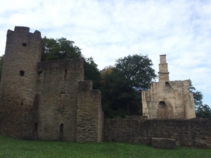
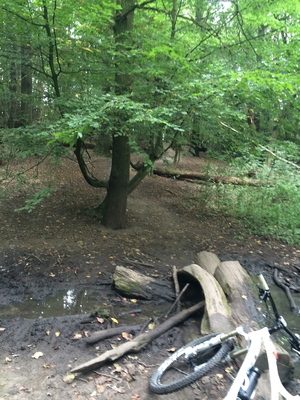
The route is medium-hard. You need a certain endurance for the mountains; it’s manageable for those who aren’t very sporty, but also for the well-trained. Sporty riders can complete it in about 1h 40min. I took a little longer today because of the app. There is a nice ruin (see the star) where you can take a good break. Where the water droplet is, you have to quickly cross the stream in a low gear, then climb a somewhat higher hill. Sometimes you have to look for the entrances because they are a bit hidden.
Have fun riding!
- -:--
- Duration
- 32.1 km
- Distance
- 232 m
- Ascent
- 230 m
- Descent
- ---
- Avg. speed
- ---
- Max. altitude
Route highlights
Points of interest along the route

Point of interest after 17.4 km
Burgruine Hardenstein

Point of interest after 26.3 km
Am Bach schnell mit einem niedrigen Gang hochfahren
Continue with Bikemap
Use, edit, or download this cycling route
You would like to ride Mountainbike 1 or customize it for your own trip? Here is what you can do with this Bikemap route:
Free features
- Save this route as favorite or in collections
- Copy & plan your own version of this route
- Sync your route with Garmin or Wahoo
Premium features
Free trial for 3 days, or one-time payment. More about Bikemap Premium.
- Navigate this route on iOS & Android
- Export a GPX / KML file of this route
- Create your custom printout (try it for free)
- Download this route for offline navigation
Discover more Premium features.
Get Bikemap PremiumFrom our community
Other popular routes starting in Witten
 Kleine Ruhrrunde
- Distance
- 52.5 km
- Ascent
- 350 m
- Descent
- 362 m
- Location
- Witten, North Rhine-Westphalia, Germany
 ride through Witten
- Distance
- 22.8 km
- Ascent
- 465 m
- Descent
- 461 m
- Location
- Witten, North Rhine-Westphalia, Germany
 Mountainbike 1
- Distance
- 32.1 km
- Ascent
- 232 m
- Descent
- 230 m
- Location
- Witten, North Rhine-Westphalia, Germany
 Witten-Duisburg - Ruhrtal-Radweg -
- Distance
- 82.9 km
- Ascent
- 145 m
- Descent
- 202 m
- Location
- Witten, North Rhine-Westphalia, Germany
 Rundkurs ums Autobahnkreuz Do-West
- Distance
- 19.9 km
- Ascent
- 93 m
- Descent
- 94 m
- Location
- Witten, North Rhine-Westphalia, Germany
 Rechts und links der Ruhr (Wetter - Witten)
- Distance
- 46.9 km
- Ascent
- 921 m
- Descent
- 922 m
- Location
- Witten, North Rhine-Westphalia, Germany
 Do-Oespel - Sprockhövel - Do-Oespel
- Distance
- 45.7 km
- Ascent
- 344 m
- Descent
- 344 m
- Location
- Witten, North Rhine-Westphalia, Germany
 ketteimmerrechts.de // kir-ig.de
- Distance
- 49.7 km
- Ascent
- 455 m
- Descent
- 458 m
- Location
- Witten, North Rhine-Westphalia, Germany
Open it in the app

