

Männerausfahrt 17.09.2016
A cycling route starting in Oberstadion, Baden-Wurttemberg, Germany.
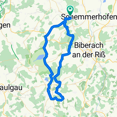
Overview
About this route
Majo
Michel
Oygi
Snorre
Band
- -:--
- Duration
- 105.5 km
- Distance
- 591 m
- Ascent
- 591 m
- Descent
- ---
- Avg. speed
- ---
- Max. altitude

Route quality
Waytypes & surfaces along the route
Waytypes
Track
48 km
(45 %)
Quiet road
33.1 km
(31 %)
Surfaces
Paved
55.8 km
(53 %)
Unpaved
27.4 km
(26 %)
Asphalt
51.6 km
(49 %)
Gravel
17.7 km
(17 %)
Route highlights
Points of interest along the route

Point of interest after 39.1 km
Zwiefalter Kloster https://de.wikipedia.org/wiki/Kloster_Zwiefalten

Point of interest after 47.7 km
Wimsener Höle https://de.wikipedia.org/wiki/Wimsener_H%C3%B6hle

Point of interest after 50.4 km
Glastal - Lämmerstein https://de.wikipedia.org/wiki/Hasenbach_(Zwiefalter_Aach)

Point of interest after 59.6 km
Burg Derneck https://de.wikipedia.org/wiki/Burg_Derneck
Point of interest after 83.1 km
http://www.brauerei-blank.de/gasthof.html
Continue with Bikemap
Use, edit, or download this cycling route
You would like to ride Männerausfahrt 17.09.2016 or customize it for your own trip? Here is what you can do with this Bikemap route:
Free features
- Save this route as favorite or in collections
- Copy & plan your own version of this route
- Split it into stages to create a multi-day tour
- Sync your route with Garmin or Wahoo
Premium features
Free trial for 3 days, or one-time payment. More about Bikemap Premium.
- Navigate this route on iOS & Android
- Export a GPX / KML file of this route
- Create your custom printout (try it for free)
- Download this route for offline navigation
Discover more Premium features.
Get Bikemap PremiumFrom our community
Other popular routes starting in Oberstadion
 Runde zum Fischerfest - Rottenacker
- Distance
- 28.7 km
- Ascent
- 120 m
- Descent
- 120 m
- Location
- Oberstadion, Baden-Wurttemberg, Germany
 Männerausfahrt 17.09.2016
- Distance
- 105.5 km
- Ascent
- 591 m
- Descent
- 591 m
- Location
- Oberstadion, Baden-Wurttemberg, Germany
 Bad Schussenried
- Distance
- 60.8 km
- Ascent
- 305 m
- Descent
- 305 m
- Location
- Oberstadion, Baden-Wurttemberg, Germany
 20130630 Laupheimer Kinderfest & Heimatfest
- Distance
- 62.8 km
- Ascent
- 139 m
- Descent
- 138 m
- Location
- Oberstadion, Baden-Wurttemberg, Germany
 Männerausfahrt 17.09.2016
- Distance
- 87.5 km
- Ascent
- 820 m
- Descent
- 825 m
- Location
- Oberstadion, Baden-Wurttemberg, Germany
 Donau Tour 2011 - Regensburg
- Distance
- 112.5 km
- Ascent
- 130 m
- Descent
- 243 m
- Location
- Oberstadion, Baden-Wurttemberg, Germany
 Oggelsb. - Ob.wachingen
- Distance
- 13 km
- Ascent
- 113 m
- Descent
- 77 m
- Location
- Oberstadion, Baden-Wurttemberg, Germany
 20121230 as quick as dirty
- Distance
- 17.4 km
- Ascent
- 197 m
- Descent
- 200 m
- Location
- Oberstadion, Baden-Wurttemberg, Germany
Open it in the app