Bia艂ogr贸d i s艂upy graniczne
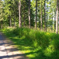
A cycling route starting in Cieszyn, Silesian Voivodeship, Poland.
Overview
About this route
Pl
- -:--
- Duration
- 80.7 km
- Distance
- 273 m
- Ascent
- 273 m
- Descent
- ---
- Avg. speed
- ---
- Max. altitude
Route highlights
Points of interest along the route
 - Photo after 32.3 km- Bia艂ogr贸d 
 - Photo after 33.4 km- S艂up X 
 - Photo after 33.6 km- S艂up IX 
 - Photo after 35 km- S艂up XI 
 - Photo after 40.8 km- S艂up XIV 
 - Photo after 44.2 km- S艂up XIII 
 - Photo after 48 km- S艂up XVI 
 - Photo after 48.9 km- S艂up XVII 
 - Photo after 49.7 km- S艂up XVIII 
 - Photo after 54 km- S艂up XX 
 - Photo after 54.9 km- S艂up XXI 
 - Photo after 58.4 km- S艂up XXII 
 - Photo after 62.6 km- S艂up XXIV 
Continue with Bikemap
Use, edit, or download this cycling route
You would like to ride Bia艂ogr贸d i s艂upy graniczne or customize it for your own trip? Here is what you can do with this Bikemap route:
Free features
- Save this route as favorite or in collections
- Copy & plan your own version of this route
- Split it into stages to create a multi-day tour
- Sync your route with Garmin or Wahoo
Premium features
Free trial for 3 days, or one-time payment. More about Bikemap Premium.
- Navigate this route on iOS & Android
- Export a GPX / KML file of this route
- Create your custom printout (try it for free)
- Download this route for offline navigation
Discover more Premium features.
Get Bikemap PremiumFrom our community
Other popular routes starting in Cieszyn
 Bia艂ogr贸d i s艂upy graniczne Bia艂ogr贸d i s艂upy graniczne- Distance
- 80.7 km
- Ascent
- 273 m
- Descent
- 273 m
- Location
- Cieszyn, Silesian Voivodeship, Poland
 
 Mi臋dzy Ostrawic膮 i 艁ucyn膮 Mi臋dzy Ostrawic膮 i 艁ucyn膮- Distance
- 69.3 km
- Ascent
- 555 m
- Descent
- 555 m
- Location
- Cieszyn, Silesian Voivodeship, Poland
 
 Cieszyn-Tatry-Cieszyn Cieszyn-Tatry-Cieszyn- Distance
- 371.9 km
- Ascent
- 2,669 m
- Descent
- 2,669 m
- Location
- Cieszyn, Silesian Voivodeship, Poland
 
 W Dolomity (12 dni) 2002r W Dolomity (12 dni) 2002r- Distance
- 2,273.5 km
- Ascent
- 34,645 m
- Descent
- 34,441 m
- Location
- Cieszyn, Silesian Voivodeship, Poland
 
 Cieszyn-Dziegielow-Goleszow-Puncow-Cieszyn Cieszyn-Dziegielow-Goleszow-Puncow-Cieszyn- Distance
- 24.3 km
- Ascent
- 271 m
- Descent
- 276 m
- Location
- Cieszyn, Silesian Voivodeship, Poland
 
 Cieszyn-Wielki Po艂om 1067-cieszyn Cieszyn-Wielki Po艂om 1067-cieszyn- Distance
- 79.6 km
- Ascent
- 859 m
- Descent
- 859 m
- Location
- Cieszyn, Silesian Voivodeship, Poland
 
 Morawka Morawka- Distance
- 88.4 km
- Ascent
- 1,102 m
- Descent
- 1,099 m
- Location
- Cieszyn, Silesian Voivodeship, Poland
 
 Groniczek, G艂owa konia, Filipka, 艁膮czka Groniczek, G艂owa konia, Filipka, 艁膮czka- Distance
- 58.8 km
- Ascent
- 772 m
- Descent
- 773 m
- Location
- Cieszyn, Silesian Voivodeship, Poland
 
Open it in the app


