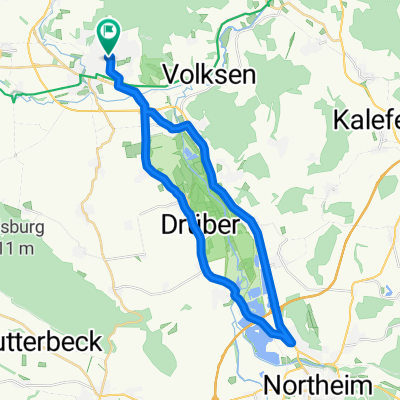
20160918 Abendtour
A cycling route starting in Einbeck, Lower Saxony, Germany.
Overview
About this route
Am Waldrand lang nach dem AWB-See fast wie Singletrail - nur flach.
- -:--
- Duration
- 25.9 km
- Distance
- 44 m
- Ascent
- 231 m
- Descent
- ---
- Avg. speed
- ---
- Avg. speed
Continue with Bikemap
Use, edit, or download this cycling route
You would like to ride 20160918 Abendtour or customize it for your own trip? Here is what you can do with this Bikemap route:
Free features
- Save this route as favorite or in collections
- Copy & plan your own version of this route
- Sync your route with Garmin or Wahoo
Premium features
Free trial for 3 days, or one-time payment. More about Bikemap Premium.
- Navigate this route on iOS & Android
- Export a GPX / KML file of this route
- Create your custom printout (try it for free)
- Download this route for offline navigation
Discover more Premium features.
Get Bikemap PremiumFrom our community
Other popular routes starting in Einbeck
- 20160918 Abendtour
- Distance
- 25.9 km
- Ascent
- 44 m
- Descent
- 231 m
- Location
- Einbeck, Lower Saxony, Germany
- Einbeck, Brücken und Grenzen
- Distance
- 28.1 km
- Ascent
- 223 m
- Descent
- 223 m
- Location
- Einbeck, Lower Saxony, Germany
- Rund um Einbeck
- Distance
- 21.7 km
- Ascent
- 128 m
- Descent
- 129 m
- Location
- Einbeck, Lower Saxony, Germany
- Ausfahrt durch Einbeck
- Distance
- 10.8 km
- Ascent
- 50 m
- Descent
- 63 m
- Location
- Einbeck, Lower Saxony, Germany
- adfcEinbeck Auf den Hoehen des Hils 20080803
- Distance
- 61.1 km
- Ascent
- 762 m
- Descent
- 658 m
- Location
- Einbeck, Lower Saxony, Germany
- Weserrunde
- Distance
- 92.2 km
- Ascent
- 571 m
- Descent
- 572 m
- Location
- Einbeck, Lower Saxony, Germany
- Umfahrung Baustelle Hullerser Landstraße Einbeck
- Distance
- 1.7 km
- Ascent
- 17 m
- Descent
- 5 m
- Location
- Einbeck, Lower Saxony, Germany
- Tour durch die westliche Ahlsburg
- Distance
- 43.9 km
- Ascent
- 536 m
- Descent
- 532 m
- Location
- Einbeck, Lower Saxony, Germany
Open it in the app