

Mariña Lucense
A cycling route starting in Trabada, Galicia, Spain.
Overview
About this route
Totally punishing profile route with the hardest stretches at the end of the course.
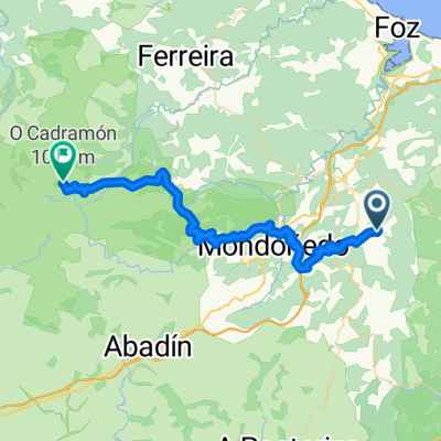
Departure from Lourenzá towards Masma, with the first climb, short but tough of the stage. After passing through the place of Masma and a brief flat stretch, we will encounter the second climb of the day, longer but gentler, up to the top of A Campa; once here we descend to Alfoz and O Valadouro, where we divert towards Foz; after a brief climb at O Calvario, we find a long straight at Moucide towards Cangas. Here another diversion towards Foz, to enter the N642; a road we will not leave until the roundabout of Asador, where we continue straight on the N634; this entire stretch from Cangas, Foz, Barreiros, and Ribadeo runs along the Cantabrian Sea. In Ribadeo, we divert towards Vegadeo, continuing along with the rhythm of the Cantabrian, until the roundabout leading to this last town, where we follow the N640 towards Pontenova/Lugo. Connecting stretch to Pontenova, passing through S. Tirso de Abres, with continuous ups and downs. After passing Pontenova, we take a turn towards Riotorto, and the fun begins; first climb to Rececende, we reach Riotorto and climb towards Cruz da Cancela, the longest and hardest climb of this stage. Upon reaching this high point, we encounter a roundabout, where we continue towards Mondoñedo, after a brief descent, we have a new unfavorable stretch uphill, until the roundabout access to the A-8 in Curros. At this roundabout, we head towards Mondoñedo, and at the next intersection (Lindín), we divert towards Sto. Tomé / Lourenzá, to recover on a nice descent, which has a final road section in quite poor condition. Almost at the end of the descent, we come across a quarry on the left hand side, we will have to take this turn to the left and follow this road that runs along the river, until a new junction with the main road from Lourenzá to Meira. Here we turn left towards Lourenzá and just 6 km left to approach and relax towards the laurentine village.
- -:--
- Duration
- 129.6 km
- Distance
- 1,244 m
- Ascent
- 1,244 m
- Descent
- ---
- Avg. speed
- ---
- Max. altitude

Continue with Bikemap
Use, edit, or download this cycling route
You would like to ride Mariña Lucense or customize it for your own trip? Here is what you can do with this Bikemap route:
Free features
- Save this route as favorite or in collections
- Copy & plan your own version of this route
- Split it into stages to create a multi-day tour
- Sync your route with Garmin or Wahoo
Premium features
Free trial for 3 days, or one-time payment. More about Bikemap Premium.
- Navigate this route on iOS & Android
- Export a GPX / KML file of this route
- Create your custom printout (try it for free)
- Download this route for offline navigation
Discover more Premium features.
Get Bikemap PremiumFrom our community
Other popular routes starting in Trabada
 Etapa 4 Vuelta España 2016. Trabada (Lugo) - Lugo
- Distance
- 99.2 km
- Ascent
- 1,149 m
- Descent
- 885 m
- Location
- Trabada, Galicia, Spain
 Lourenzá - As Pontes - Lourenzá
- Distance
- 149.1 km
- Ascent
- 1,074 m
- Descent
- 1,074 m
- Location
- Trabada, Galicia, Spain
 Playas de Ribadeo - Barreiros
- Distance
- 69.7 km
- Ascent
- 343 m
- Descent
- 344 m
- Location
- Trabada, Galicia, Spain
 CANEDO-CADRAMON
- Distance
- 41.6 km
- Ascent
- 1,602 m
- Descent
- 697 m
- Location
- Trabada, Galicia, Spain
 Lugar Betais, 4, Ribadeo naar Rúa San Francisco, 1, Ribadeo
- Distance
- 10.5 km
- Ascent
- 222 m
- Descent
- 255 m
- Location
- Trabada, Galicia, Spain
 22 Villanova - Curtis
- Distance
- 101 km
- Ascent
- 1,156 m
- Descent
- 697 m
- Location
- Trabada, Galicia, Spain
 ES02 - Mondonhedo to Gijón/Xixón
- Distance
- 204.5 km
- Ascent
- 3,740 m
- Descent
- 3,899 m
- Location
- Trabada, Galicia, Spain
 Recorrendo a mariña Lucense
- Distance
- 120.9 km
- Ascent
- 1,677 m
- Descent
- 1,676 m
- Location
- Trabada, Galicia, Spain
Open it in the app