

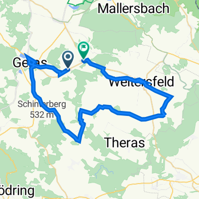
Lange Ausfahrt von Geras nach Hollabrunn
A cycling route starting in Geras, Lower Austria, Austria.
Overview
About this route
- -:--
- Duration
- 55.8 km
- Distance
- 253 m
- Ascent
- 485 m
- Descent
- ---
- Avg. speed
- ---
- Max. altitude

Route photos

Route quality
Waytypes & surfaces along the route
Waytypes
Track
37.4 km
(67 %)
Quiet road
8.4 km
(15 %)
Surfaces
Paved
13.9 km
(25 %)
Unpaved
20.6 km
(37 %)
Gravel
11.7 km
(21 %)
Paved (undefined)
7.8 km
(14 %)
Route highlights
Points of interest along the route

Point of interest after 34.6 km
Rastplatzerl vor Roseldorf am Ufer der Schmida

Point of interest after 34.6 km
Das Kircherl von Pulkau im Hintergrund
Continue with Bikemap
Use, edit, or download this cycling route
You would like to ride Lange Ausfahrt von Geras nach Hollabrunn or customize it for your own trip? Here is what you can do with this Bikemap route:
Free features
- Save this route as favorite or in collections
- Copy & plan your own version of this route
- Sync your route with Garmin or Wahoo
Premium features
Free trial for 3 days, or one-time payment. More about Bikemap Premium.
- Navigate this route on iOS & Android
- Export a GPX / KML file of this route
- Create your custom printout (try it for free)
- Download this route for offline navigation
Discover more Premium features.
Get Bikemap PremiumFrom our community
Other popular routes starting in Geras
 geras _gars _langenlois __st pölten
- Distance
- 98.4 km
- Ascent
- 948 m
- Descent
- 1,134 m
- Location
- Geras, Lower Austria, Austria
 Vorstadt nach Unterretzbach
- Distance
- 66.8 km
- Ascent
- 831 m
- Descent
- 1,056 m
- Location
- Geras, Lower Austria, Austria
 L40 nach Oberhöflein 27
- Distance
- 39.3 km
- Ascent
- 1,032 m
- Descent
- 900 m
- Location
- Geras, Lower Austria, Austria
 BA GERAS HNANICE CIZOV SAVOV
- Distance
- 68.1 km
- Ascent
- 984 m
- Descent
- 987 m
- Location
- Geras, Lower Austria, Austria
 GERAS VRANOV CICOV HARDEGG ERICH
- Distance
- 63.2 km
- Ascent
- 962 m
- Descent
- 968 m
- Location
- Geras, Lower Austria, Austria
 Graslweg Thaya
- Distance
- 33.8 km
- Ascent
- 349 m
- Descent
- 408 m
- Location
- Geras, Lower Austria, Austria
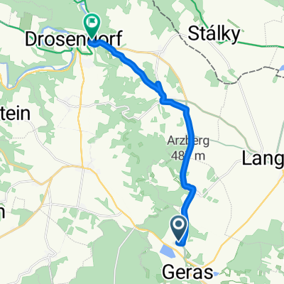 Bahnstraße, Geras nach Drosendorf Altstadt, Drosendorf-Zissersdorf
- Distance
- 10 km
- Ascent
- 74 m
- Descent
- 166 m
- Location
- Geras, Lower Austria, Austria
 Urlaub 21 8 Etappe
- Distance
- 62.5 km
- Ascent
- 380 m
- Descent
- 344 m
- Location
- Geras, Lower Austria, Austria
Open it in the app