

AnchorBay-Geysers-Guerneville
A cycling route starting in Guerneville, California, United States.
Overview
About this route
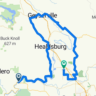
Third Segment of a 4-day bike trip Tamalpais Valley > Guerneville > Anchor Bay > Geysers > Tamalpais Valley
- -:--
- Duration
- 185.9 km
- Distance
- 2,753 m
- Ascent
- 2,649 m
- Descent
- ---
- Avg. speed
- ---
- Max. altitude

Continue with Bikemap
Use, edit, or download this cycling route
You would like to ride AnchorBay-Geysers-Guerneville or customize it for your own trip? Here is what you can do with this Bikemap route:
Free features
- Save this route as favorite or in collections
- Copy & plan your own version of this route
- Split it into stages to create a multi-day tour
- Sync your route with Garmin or Wahoo
Premium features
Free trial for 3 days, or one-time payment. More about Bikemap Premium.
- Navigate this route on iOS & Android
- Export a GPX / KML file of this route
- Create your custom printout (try it for free)
- Download this route for offline navigation
Discover more Premium features.
Get Bikemap PremiumFrom our community
Other popular routes starting in Guerneville
 Vineman 70.3 Bike Course
- Distance
- 85.7 km
- Ascent
- 442 m
- Descent
- 427 m
- Location
- Guerneville, California, United States
 AnchorBay-Geysers-Guerneville
- Distance
- 185.9 km
- Ascent
- 2,753 m
- Descent
- 2,649 m
- Location
- Guerneville, California, United States
 Vineman 70.3 Triathlon
- Distance
- 89.2 km
- Ascent
- 585 m
- Descent
- 566 m
- Location
- Guerneville, California, United States
 Rio Nido1
- Distance
- 77.7 km
- Ascent
- 866 m
- Descent
- 866 m
- Location
- Guerneville, California, United States
 Sweetwater - Westside - River
- Distance
- 40.2 km
- Ascent
- 617 m
- Descent
- 617 m
- Location
- Guerneville, California, United States
 Guerneville - AnchorBay
- Distance
- 95.6 km
- Ascent
- 1,133 m
- Descent
- 1,040 m
- Location
- Guerneville, California, United States
 Guerneville to tamalpais valley
- Distance
- 127.3 km
- Ascent
- 818 m
- Descent
- 808 m
- Location
- Guerneville, California, United States
 Guerneville-Cazadaro-Ft Ross Rd-Myers Grade
- Distance
- 73.3 km
- Ascent
- 850 m
- Descent
- 850 m
- Location
- Guerneville, California, United States
Open it in the app