

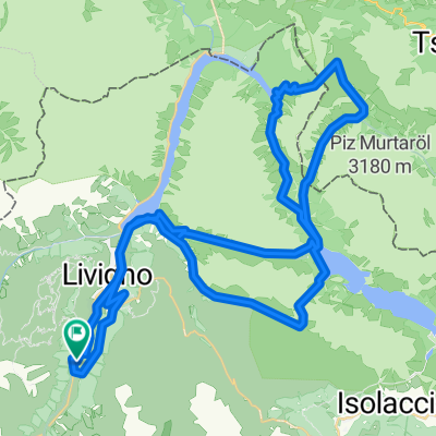
Livigno camp - Pass Forcola di Livigno - Pass da Val Viola - Passo della Vallacia - Passo d`Eira - singl do Val delle Mine
A cycling route starting in Livigno, Lombardy, Italy.
Overview
About this route
- -:--
- Duration
- 63.7 km
- Distance
- 2,061 m
- Ascent
- 2,079 m
- Descent
- ---
- Avg. speed
- ---
- Max. altitude

Continue with Bikemap
Use, edit, or download this cycling route
You would like to ride Livigno camp - Pass Forcola di Livigno - Pass da Val Viola - Passo della Vallacia - Passo d`Eira - singl do Val delle Mine or customize it for your own trip? Here is what you can do with this Bikemap route:
Free features
- Save this route as favorite or in collections
- Copy & plan your own version of this route
- Sync your route with Garmin or Wahoo
Premium features
Free trial for 3 days, or one-time payment. More about Bikemap Premium.
- Navigate this route on iOS & Android
- Export a GPX / KML file of this route
- Create your custom printout (try it for free)
- Download this route for offline navigation
Discover more Premium features.
Get Bikemap PremiumFrom our community
Other popular routes starting in Livigno
 Livigno - Passo del Gallo
- Distance
- 65.7 km
- Ascent
- 1,621 m
- Descent
- 1,621 m
- Location
- Livigno, Lombardy, Italy
 livigno stelvio
- Distance
- 54.9 km
- Ascent
- 2,108 m
- Descent
- 1,178 m
- Location
- Livigno, Lombardy, Italy
 Passo Di Vale Alpisella
- Distance
- 8.3 km
- Ascent
- 555 m
- Descent
- 675 m
- Location
- Livigno, Lombardy, Italy
 Livigno camp - Pass Forcola di Livigno - Pass da Val Viola - Passo della Vallacia - Passo d`Eira - singl do Val delle Mine
- Distance
- 63.7 km
- Ascent
- 2,061 m
- Descent
- 2,079 m
- Location
- Livigno, Lombardy, Italy
 Giro delle tee
- Distance
- 22.3 km
- Ascent
- 384 m
- Descent
- 386 m
- Location
- Livigno, Lombardy, Italy
 Livigno - S.ta Maria (TorTour 2008 - 1)
- Distance
- 45.4 km
- Ascent
- 1,233 m
- Descent
- 1,679 m
- Location
- Livigno, Lombardy, Italy
 Livigno - Mottolino Flow Trail
- Distance
- 25 km
- Ascent
- 823 m
- Descent
- 823 m
- Location
- Livigno, Lombardy, Italy
 Livigno, Mottolino (mit der Bahn), Passo d'Eira, Ponte del Rez, Passo di Foscagno, Valle di FoscagnTorn di Fraele, Rifugio Monte Scale Park, Valle Alpisella, Li
- Distance
- 43 km
- Ascent
- 932 m
- Descent
- 1,472 m
- Location
- Livigno, Lombardy, Italy
Open it in the app