

Fusea Bis
A cycling route starting in Tolmezzo, Friuli Venezia Giulia, Italy.
Overview
About this route
Da verificare il collegamento tra le due strade nei pressi del POI inserito
- -:--
- Duration
- 29.1 km
- Distance
- 1,282 m
- Ascent
- 1,282 m
- Descent
- ---
- Avg. speed
- ---
- Max. altitude

Route quality
Waytypes & surfaces along the route
Waytypes
Track
13.6 km
(47 %)
Quiet road
10.8 km
(37 %)
Surfaces
Paved
2.9 km
(10 %)
Unpaved
15.8 km
(54 %)
Gravel
12.5 km
(43 %)
Ground
3.3 km
(11 %)
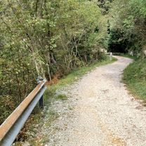
Route highlights
Points of interest along the route
Point of interest after 16.9 km
Da verificare il collegamento
Continue with Bikemap
Use, edit, or download this cycling route
You would like to ride Fusea Bis or customize it for your own trip? Here is what you can do with this Bikemap route:
Free features
- Save this route as favorite or in collections
- Copy & plan your own version of this route
- Sync your route with Garmin or Wahoo
Premium features
Free trial for 3 days, or one-time payment. More about Bikemap Premium.
- Navigate this route on iOS & Android
- Export a GPX / KML file of this route
- Create your custom printout (try it for free)
- Download this route for offline navigation
Discover more Premium features.
Get Bikemap PremiumFrom our community
Other popular routes starting in Tolmezzo
 Malga di Claupa
- Distance
- 36.4 km
- Ascent
- 1,767 m
- Descent
- 1,483 m
- Location
- Tolmezzo, Friuli Venezia Giulia, Italy
 Giro della Carnia
- Distance
- 141.1 km
- Ascent
- 2,705 m
- Descent
- 2,709 m
- Location
- Tolmezzo, Friuli Venezia Giulia, Italy
 Tualis - P.sso M.te Croce Carnico
- Distance
- 96.7 km
- Ascent
- 1,506 m
- Descent
- 1,508 m
- Location
- Tolmezzo, Friuli Venezia Giulia, Italy
 Monte Oltreviso
- Distance
- 56 km
- Ascent
- 1,611 m
- Descent
- 1,485 m
- Location
- Tolmezzo, Friuli Venezia Giulia, Italy
 giro della Carnia
- Distance
- 58.9 km
- Ascent
- 1,065 m
- Descent
- 1,112 m
- Location
- Tolmezzo, Friuli Venezia Giulia, Italy
 Tolmezzo Sauris Pesariis Tolmezzo
- Distance
- 102.9 km
- Ascent
- 1,954 m
- Descent
- 1,956 m
- Location
- Tolmezzo, Friuli Venezia Giulia, Italy
 Da Piazza XX Settembre 23, Tolmezzo a Via Nazionale 33, Gemona
- Distance
- 21.5 km
- Ascent
- 778 m
- Descent
- 825 m
- Location
- Tolmezzo, Friuli Venezia Giulia, Italy
 Zoncolan, Priola
- Distance
- 63.7 km
- Ascent
- 2,430 m
- Descent
- 2,410 m
- Location
- Tolmezzo, Friuli Venezia Giulia, Italy
Open it in the app