
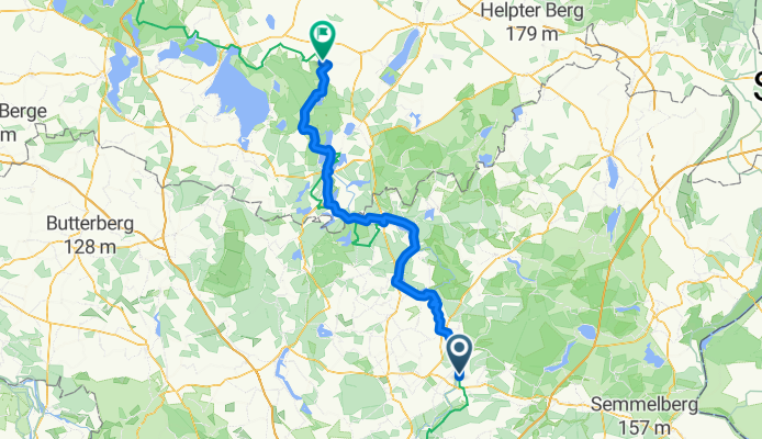
20160714_090201.gpx
A cycling route starting in Liebenwalde, Brandenburg, Germany.
Overview
About this route
TEASI track
- -:--
- Duration
- 111 km
- Distance
- 226 m
- Ascent
- 187 m
- Descent
- ---
- Avg. speed
- ---
- Max. altitude

Route quality
Waytypes & surfaces along the route
Waytypes
Quiet road
48.9 km
(44 %)
Road
22.2 km
(20 %)
Surfaces
Paved
91 km
(82 %)
Unpaved
3.3 km
(3 %)
Asphalt
84.4 km
(76 %)
Concrete
6.7 km
(6 %)
Route highlights
Points of interest along the route
Point of interest after 30.9 km
53°03.837' 13°12.069'
Continue with Bikemap
Use, edit, or download this cycling route
You would like to ride 20160714_090201.gpx or customize it for your own trip? Here is what you can do with this Bikemap route:
Free features
- Save this route as favorite or in collections
- Copy & plan your own version of this route
- Split it into stages to create a multi-day tour
- Sync your route with Garmin or Wahoo
Premium features
Free trial for 3 days, or one-time payment. More about Bikemap Premium.
- Navigate this route on iOS & Android
- Export a GPX / KML file of this route
- Create your custom printout (try it for free)
- Download this route for offline navigation
Discover more Premium features.
Get Bikemap PremiumFrom our community
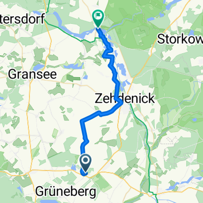
Other popular routes starting in Liebenwalde
 Tagestour Liebenwalde-Rheinsberg
- Distance
- 50.3 km
- Ascent
- 133 m
- Descent
- 117 m
- Location
- Liebenwalde, Brandenburg, Germany
 Parkweg, Löwenberger Land nach Marienthaler Dorfstraße, Fürstenberg/Havel
- Distance
- 26.7 km
- Ascent
- 73 m
- Descent
- 75 m
- Location
- Liebenwalde, Brandenburg, Germany
 T3 Spandau
- Distance
- 59.4 km
- Ascent
- 72 m
- Descent
- 82 m
- Location
- Liebenwalde, Brandenburg, Germany
 Brandenburg Barrierefrei - Handbiketour Grüneberg
- Distance
- 33.8 km
- Ascent
- 88 m
- Descent
- 88 m
- Location
- Liebenwalde, Brandenburg, Germany
 Berlin Rostock 2. Etappe CLONED FROM ROUTE 131274
- Distance
- 90.5 km
- Ascent
- 222 m
- Descent
- 201 m
- Location
- Liebenwalde, Brandenburg, Germany
 20160714_090201.gpx
- Distance
- 111 km
- Ascent
- 226 m
- Descent
- 187 m
- Location
- Liebenwalde, Brandenburg, Germany
 Liebenberg - Lichtenstein
- Distance
- 299 km
- Ascent
- 663 m
- Descent
- 398 m
- Location
- Liebenwalde, Brandenburg, Germany
 Liebenwalde nach Zollbrücke
- Distance
- 77.1 km
- Ascent
- 116 m
- Descent
- 156 m
- Location
- Liebenwalde, Brandenburg, Germany
Open it in the app