

Haut Follin
A cycling route starting in Étang-sur-Arroux, Bourgogne-Franche-Comté, France.
Overview
About this route
The Haut-Folin is the summit of the Morvan and Burgundy (alt 901 m). It is located on the border of the Nièvre and Saône-et-Loire departments. Ski trails for cross-country skiing have been established there since 1980. (5 trails totaling 40 km). They are groomed as soon as there is 20 cm of snow.
- -:--
- Duration
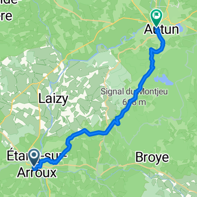
- 24.9 km
- Distance
- 630 m
- Ascent
- 630 m
- Descent
- ---
- Avg. speed
- ---
- Max. altitude
Continue with Bikemap
Use, edit, or download this cycling route
You would like to ride Haut Follin or customize it for your own trip? Here is what you can do with this Bikemap route:
Free features
- Save this route as favorite or in collections
- Copy & plan your own version of this route
- Sync your route with Garmin or Wahoo
Premium features
Free trial for 3 days, or one-time payment. More about Bikemap Premium.
- Navigate this route on iOS & Android
- Export a GPX / KML file of this route
- Create your custom printout (try it for free)
- Download this route for offline navigation
Discover more Premium features.
Get Bikemap PremiumFrom our community
Other popular routes starting in Étang-sur-Arroux
 le mont beuvray
- Distance
- 65.4 km
- Ascent
- 1,208 m
- Descent
- 1,208 m
- Location
- Étang-sur-Arroux, Bourgogne-Franche-Comté, France
 Tour um den Mont Beuvray
- Distance
- 55.3 km
- Ascent
- 892 m
- Descent
- 872 m
- Location
- Étang-sur-Arroux, Bourgogne-Franche-Comté, France
 Haut follin
- Distance
- 25.4 km
- Ascent
- 699 m
- Descent
- 699 m
- Location
- Étang-sur-Arroux, Bourgogne-Franche-Comté, France
 Haut Follin
- Distance
- 24.9 km
- Ascent
- 630 m
- Descent
- 630 m
- Location
- Étang-sur-Arroux, Bourgogne-Franche-Comté, France
 From Étang-sur-Arroux to Autun
- Distance
- 18.1 km
- Ascent
- 412 m
- Descent
- 383 m
- Location
- Étang-sur-Arroux, Bourgogne-Franche-Comté, France
 El Parque Natural Regional del Morvan
- Distance
- 86.1 km
- Ascent
- 1,236 m
- Descent
- 1,237 m
- Location
- Étang-sur-Arroux, Bourgogne-Franche-Comté, France
 Montchenis St Prix und zurück
- Distance
- 33.5 km
- Ascent
- 507 m
- Descent
- 508 m
- Location
- Étang-sur-Arroux, Bourgogne-Franche-Comté, France
 Velotour Burgund_07. Tag
- Distance
- 37.2 km
- Ascent
- 662 m
- Descent
- 482 m
- Location
- Étang-sur-Arroux, Bourgogne-Franche-Comté, France
Open it in the app