

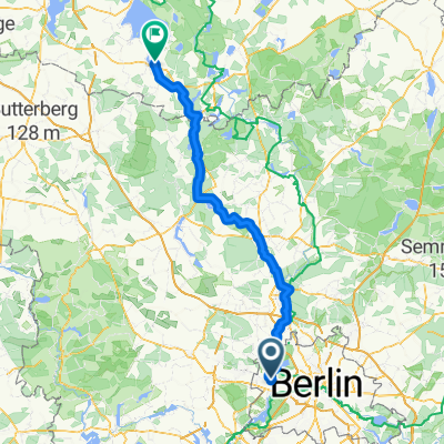
Spandau>>Charlottenburger Schloss
A cycling route starting in Spandau, State of Berlin, Germany.
Overview
About this route
Vom Bahnhof Spandau, an der Altstadt Spandau vorbei durch das nicht so tolle Industriegebiet. Wer es bis dahin geschafft hat wird ab dann durch einen schönen Radweg am Wasser entlang durch Laubenkolonien belohnt. Höhepunkt ist das Schloss Charlottenburg mit seinem wunderschönen Schloßgarten incl. Liegewiesen und schönem Kinderspielplatz
- -:--
- Duration
- 8.1 km
- Distance
- 10 m
- Ascent
- 10 m
- Descent
- ---
- Avg. speed
- 37 m
- Max. altitude
Route quality
Waytypes & surfaces along the route
Waytypes
Pedestrian area
4.2 km
(51 %)
Road
3.3 km
(40 %)
Surfaces
Paved
3.7 km
(46 %)
Unpaved
4.2 km
(51 %)
Asphalt
3.6 km
(44 %)
Loose gravel
2 km
(25 %)
Route highlights
Points of interest along the route
Point of interest after 0 km
Start: Bahnhof Spandau
Continue with Bikemap
Use, edit, or download this cycling route
You would like to ride Spandau>>Charlottenburger Schloss or customize it for your own trip? Here is what you can do with this Bikemap route:
Free features
- Save this route as favorite or in collections
- Copy & plan your own version of this route
- Sync your route with Garmin or Wahoo
Premium features
Free trial for 3 days, or one-time payment. More about Bikemap Premium.
- Navigate this route on iOS & Android
- Export a GPX / KML file of this route
- Create your custom printout (try it for free)
- Download this route for offline navigation
Discover more Premium features.
Get Bikemap PremiumFrom our community
Other popular routes starting in Spandau
 Tegeler See - Spandau - Rundtour
- Distance
- 19.7 km
- Ascent
- 66 m
- Descent
- 66 m
- Location
- Spandau, State of Berlin, Germany
 Berlin Spandau nadr.-Zeltplatz Saatwinkel
- Distance
- 7.1 km
- Ascent
- 27 m
- Descent
- 24 m
- Location
- Spandau, State of Berlin, Germany
 Altstädter Ring, Berlin nach Müritzstraße, Rechlin
- Distance
- 129.8 km
- Ascent
- 563 m
- Descent
- 534 m
- Location
- Spandau, State of Berlin, Germany
 Berlin-Tour
- Distance
- 651.5 km
- Ascent
- 195 m
- Descent
- 230 m
- Location
- Spandau, State of Berlin, Germany
 4. RTF "Ins Märkische Luch" 153 km / Umleitung
- Distance
- 152.6 km
- Ascent
- 154 m
- Descent
- 154 m
- Location
- Spandau, State of Berlin, Germany
 Spandau-Potsdam
- Distance
- 31.9 km
- Ascent
- 149 m
- Descent
- 144 m
- Location
- Spandau, State of Berlin, Germany
 am Havelkanal
- Distance
- 31.3 km
- Ascent
- 74 m
- Descent
- 72 m
- Location
- Spandau, State of Berlin, Germany
 Rathaus Spandau - Sacrower Schlosspark und zurück
- Distance
- 48.1 km
- Ascent
- 134 m
- Descent
- 136 m
- Location
- Spandau, State of Berlin, Germany
Open it in the app