
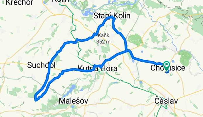
Chotusice - St. Kolín - Červené Pečky - Kutná Hora - Chotusice
A cycling route starting in Čáslav, Central Bohemia, Czechia.
Overview
About this route
- -:--
- Duration
- 51.9 km
- Distance
- 324 m
- Ascent
- 324 m
- Descent
- ---
- Avg. speed
- ---
- Max. altitude

Route quality
Waytypes & surfaces along the route
Waytypes
Road
29 km
(56 %)
Quiet road
13 km
(25 %)
Surfaces
Paved
33.7 km
(65 %)
Unpaved
0.5 km
(1 %)
Asphalt
33.7 km
(65 %)
Gravel
0.5 km
(1 %)
Undefined
17.6 km
(34 %)
Continue with Bikemap
Use, edit, or download this cycling route
You would like to ride Chotusice - St. Kolín - Červené Pečky - Kutná Hora - Chotusice or customize it for your own trip? Here is what you can do with this Bikemap route:
Free features
- Save this route as favorite or in collections
- Copy & plan your own version of this route
- Sync your route with Garmin or Wahoo
Premium features
Free trial for 3 days, or one-time payment. More about Bikemap Premium.
- Navigate this route on iOS & Android
- Export a GPX / KML file of this route
- Create your custom printout (try it for free)
- Download this route for offline navigation
Discover more Premium features.
Get Bikemap PremiumFrom our community
Other popular routes starting in Čáslav
 Čáslav - Vrdy - Vynaře - Starkoč - Čáslav
- Distance
- 29.1 km
- Ascent
- 136 m
- Descent
- 136 m
- Location
- Čáslav, Central Bohemia, Czechia
 80 km rov
- Distance
- 80 km
- Ascent
- 270 m
- Descent
- 271 m
- Location
- Čáslav, Central Bohemia, Czechia
 96 kopce Seč
- Distance
- 96.3 km
- Ascent
- 965 m
- Descent
- 965 m
- Location
- Čáslav, Central Bohemia, Czechia
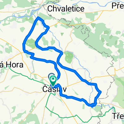 Čáslav - Žleby - Kačina - Čáslav
- Distance
- 54 km
- Ascent
- 164 m
- Descent
- 145 m
- Location
- Čáslav, Central Bohemia, Czechia
 Caslav - Tisa skala
- Distance
- 8.5 km
- Ascent
- 146 m
- Descent
- 28 m
- Location
- Čáslav, Central Bohemia, Czechia
 Čáslav - Vodranty - Žaky - Žleby - Bílé Podolí - Čáslav
- Distance
- 46 km
- Ascent
- 272 m
- Descent
- 265 m
- Location
- Čáslav, Central Bohemia, Czechia
 Čáslav - Kačina - Čáslav
- Distance
- 36.2 km
- Ascent
- 109 m
- Descent
- 109 m
- Location
- Čáslav, Central Bohemia, Czechia
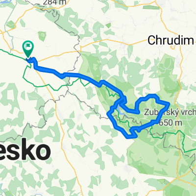
 Zubr
Zubr- Distance
- 79.4 km
- Ascent
- 844 m
- Descent
- 819 m
- Location
- Čáslav, Central Bohemia, Czechia
Open it in the app