

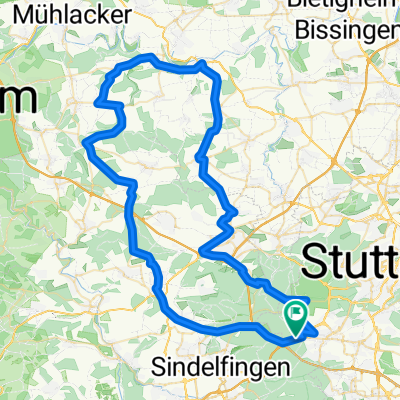
Böblingen > Stuttgart > Ludwigsburg
A cycling route starting in Sindelfingen, Baden-Wurttemberg, Germany.
Overview
About this route
-
6km Singletrail "Ami-Trail" near Böblingen
-
Downhill-Track Stuttgart (Degerloch)
-
Solitudealley back to Ludwigburg
- -:--
- Duration
- 50 km
- Distance
- 574 m
- Ascent
- 730 m
- Descent
- ---
- Avg. speed
- ---
- Max. altitude
Continue with Bikemap
Use, edit, or download this cycling route
You would like to ride Böblingen > Stuttgart > Ludwigsburg or customize it for your own trip? Here is what you can do with this Bikemap route:
Free features
- Save this route as favorite or in collections
- Copy & plan your own version of this route
- Sync your route with Garmin or Wahoo
Premium features
Free trial for 3 days, or one-time payment. More about Bikemap Premium.
- Navigate this route on iOS & Android
- Export a GPX / KML file of this route
- Create your custom printout (try it for free)
- Download this route for offline navigation
Discover more Premium features.
Get Bikemap PremiumFrom our community
Other popular routes starting in Sindelfingen
 Sindelfingen-Siebenmühlental
- Distance
- 25.1 km
- Ascent
- 215 m
- Descent
- 226 m
- Location
- Sindelfingen, Baden-Wurttemberg, Germany
 Parkhotel Leinfelden Echterdingen und Siebenmühlental
- Distance
- 30 km
- Ascent
- 302 m
- Descent
- 302 m
- Location
- Sindelfingen, Baden-Wurttemberg, Germany
 Route nach Stuttgart
- Distance
- 10.7 km
- Ascent
- 120 m
- Descent
- 80 m
- Location
- Sindelfingen, Baden-Wurttemberg, Germany
 Kurze Runde um BB (62,5km)
- Distance
- 62.5 km
- Ascent
- 454 m
- Descent
- 439 m
- Location
- Sindelfingen, Baden-Wurttemberg, Germany
 S-Vaihingen Renningen Mönse Iptingen Gr-Glattbach Enzweihingen Heimse Leo
- Distance
- 79.4 km
- Ascent
- 878 m
- Descent
- 975 m
- Location
- Sindelfingen, Baden-Wurttemberg, Germany
 Lange Runde durch den Nordschwarzwald
- Distance
- 172.3 km
- Ascent
- 2,412 m
- Descent
- 2,413 m
- Location
- Sindelfingen, Baden-Wurttemberg, Germany
 Thermaltour
- Distance
- 16.7 km
- Ascent
- 227 m
- Descent
- 226 m
- Location
- Sindelfingen, Baden-Wurttemberg, Germany
 Runde Kaltenbronn
- Distance
- 152.5 km
- Ascent
- 2,273 m
- Descent
- 2,273 m
- Location
- Sindelfingen, Baden-Wurttemberg, Germany
Open it in the app