

Wanderung im Großen Lautertal
A cycling route starting in Mehrstetten, Baden-Wurttemberg, Germany.
Overview
About this route
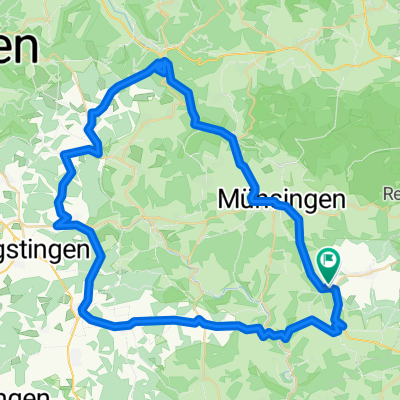
We start this beautiful hike in Hundersingen. First, we go along the left valley edge towards Fladhof. At the height, we head south towards Steighof. Shortly after Steighof, we reach the viewpoint Bürzel. Here you have a wonderful view of the Umlaufberg with the ruins of Niedergundelfingen Castle and the opposite ruins of Hohengundelfingen Castle. On narrow paths, grassy and forest trails, we come to the ruins of Derneck Castle (hiking shelter of the Schwäbischer Albverein). After we have rested there, we take a detour to Käpfle, with its Stations of the Cross. Then we hike along the valley path through Gundelfingen and Bichishausen back to Hundersingen. However, we must share the valley path with cyclists.
- -:--
- Duration
- 15.5 km
- Distance
- 324 m
- Ascent
- 324 m
- Descent
- ---
- Avg. speed
- ---
- Max. altitude
Route quality
Waytypes & surfaces along the route
Waytypes
Track
11.5 km
(74 %)
Quiet road
2.3 km
(15 %)
Surfaces
Paved
5.1 km
(33 %)
Unpaved
7.9 km
(51 %)
Asphalt
4 km
(26 %)
Unpaved (undefined)
2.2 km
(14 %)
Continue with Bikemap
Use, edit, or download this cycling route
You would like to ride Wanderung im Großen Lautertal or customize it for your own trip? Here is what you can do with this Bikemap route:
Free features
- Save this route as favorite or in collections
- Copy & plan your own version of this route
- Sync your route with Garmin or Wahoo
Premium features
Free trial for 3 days, or one-time payment. More about Bikemap Premium.
- Navigate this route on iOS & Android
- Export a GPX / KML file of this route
- Create your custom printout (try it for free)
- Download this route for offline navigation
Discover more Premium features.
Get Bikemap PremiumFrom our community
Other popular routes starting in Mehrstetten
 schwäbsche alb
- Distance
- 65.9 km
- Ascent
- 676 m
- Descent
- 675 m
- Location
- Mehrstetten, Baden-Wurttemberg, Germany
 Burg Teck
- Distance
- 69.5 km
- Ascent
- 1,801 m
- Descent
- 1,765 m
- Location
- Mehrstetten, Baden-Wurttemberg, Germany
 Meine Gegend
- Distance
- 118.2 km
- Ascent
- 1,260 m
- Descent
- 1,232 m
- Location
- Mehrstetten, Baden-Wurttemberg, Germany
 S>L T2 Hotel-Landgasthof Krone
- Distance
- 72.2 km
- Ascent
- 550 m
- Descent
- 597 m
- Location
- Mehrstetten, Baden-Wurttemberg, Germany
 Hundersingen- Kloster Marchtal-Schloss Mochental-Bremelau und zurück
- Distance
- 50.3 km
- Ascent
- 960 m
- Descent
- 959 m
- Location
- Mehrstetten, Baden-Wurttemberg, Germany
 Bioshärengebiet Münsingen
- Distance
- 41.3 km
- Ascent
- 600 m
- Descent
- 599 m
- Location
- Mehrstetten, Baden-Wurttemberg, Germany
 Sonntagstour 150802
- Distance
- 39.8 km
- Ascent
- 366 m
- Descent
- 372 m
- Location
- Mehrstetten, Baden-Wurttemberg, Germany
 90km Ehingen - Vaihingen
- Distance
- 90.2 km
- Ascent
- 613 m
- Descent
- 872 m
- Location
- Mehrstetten, Baden-Wurttemberg, Germany
Open it in the app