

Požega
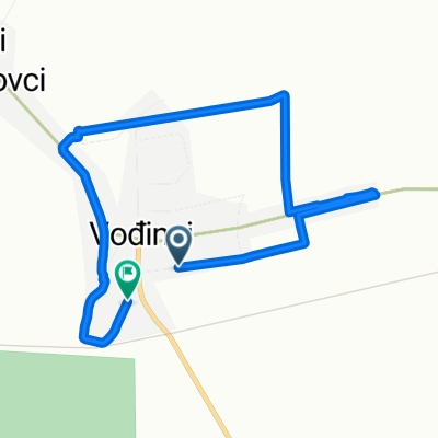
A cycling route starting in Vođinci, Vukovar-Srijem County, Croatia.
Overview
About this route
Vrbica - Našice - Orahovica - Petrov vrh - Požega - Čaglin - Slobodna Vlast - Vrbica
211 km / 1130 m
- -:--
- Duration
- 211.6 km
- Distance
- 901 m
- Ascent
- 903 m
- Descent
- ---
- Avg. speed
- ---
- Max. altitude

Route quality
Waytypes & surfaces along the route
Waytypes
Quiet road
16.9 km
(8 %)
Track
16.9 km
(8 %)
Surfaces
Paved
163 km
(77 %)
Asphalt
163 km
(77 %)
Undefined
48.7 km
(23 %)
Continue with Bikemap
Use, edit, or download this cycling route
You would like to ride Požega or customize it for your own trip? Here is what you can do with this Bikemap route:
Free features
- Save this route as favorite or in collections
- Copy & plan your own version of this route
- Split it into stages to create a multi-day tour
- Sync your route with Garmin or Wahoo
Premium features
Free trial for 3 days, or one-time payment. More about Bikemap Premium.
- Navigate this route on iOS & Android
- Export a GPX / KML file of this route
- Create your custom printout (try it for free)
- Download this route for offline navigation
Discover more Premium features.
Get Bikemap PremiumFrom our community
Other popular routes starting in Vođinci
 vrbica - sovsko jezero - slavonski brod
- Distance
- 84 km
- Ascent
- 576 m
- Descent
- 598 m
- Location
- Vođinci, Vukovar-Srijem County, Croatia
 Požega brda
- Distance
- 208.8 km
- Ascent
- 1,154 m
- Descent
- 1,160 m
- Location
- Vođinci, Vukovar-Srijem County, Croatia
 Požega
- Distance
- 211.6 km
- Ascent
- 901 m
- Descent
- 903 m
- Location
- Vođinci, Vukovar-Srijem County, Croatia
 Road and forest route
- Distance
- 22.1 km
- Ascent
- 26 m
- Descent
- 27 m
- Location
- Vođinci, Vukovar-Srijem County, Croatia
 Stari Mikanovci to Stari Mikanovci
- Distance
- 29.9 km
- Ascent
- 54 m
- Descent
- 51 m
- Location
- Vođinci, Vukovar-Srijem County, Croatia
 Vrbica - Slobodna Vlast
- Distance
- 45 km
- Ascent
- 241 m
- Descent
- 131 m
- Location
- Vođinci, Vukovar-Srijem County, Croatia
 Vlak i bicikl: Vođinci-B. Greda-Šamac
- Distance
- 36.6 km
- Ascent
- 13 m
- Descent
- 12 m
- Location
- Vođinci, Vukovar-Srijem County, Croatia
 Ulica Braće Radić to Kolodvorska ulica
- Distance
- 7.5 km
- Ascent
- 22 m
- Descent
- 69 m
- Location
- Vođinci, Vukovar-Srijem County, Croatia
Open it in the app